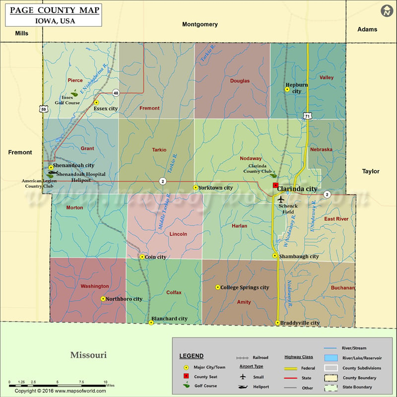
Airports in Page County Airport Name Schenck Field Shenandoah Hospital Heliport Cities in Page County City Population Latitude Longitude Blanchard city 38 40.580793 -95.221452 Braddyville city 159 40.580631 -95.031186 Clarinda…
Airports in Page County
Airport Name
Schenck Field
Shenandoah Hospital Heliport
Cities in Page County
City
Population
Latitude
Longitude
Blanchard city
38
40.580793
-95.221452
Braddyville city
159
40.580631
-95.031186
Clarinda city
5572
40.738011
-95.034004
Coin city
193
40.656063
-95.234873
College Springs city
214
40.62129
-95.121118
Essex city
798
40.832679
-95.303807
Hepburn city
23
40.847657
-95.016686
Northboro city
58
40.608017
-95.293638
Shambaugh city
191
40.657475
-95.035247
Shenandoah city
5150
40.758302
-95.372058
Yorktown city
85
40.735369
-95.154396
Golf Courses in Page County
Name of Golf Course
Latitude
Longitude
American Legion Country Club-Shenandoah
40.750202
-95.373814
Clarinda Country Club-Clarinda
40.750488
-95.037614
Essex Golf Course-Essex
40.843528
-95.336936

 Wall Maps