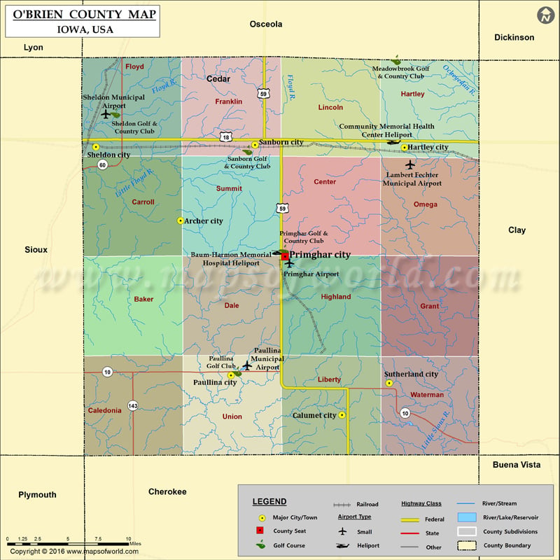
Airports in O’Brien County Airport Name Baum-Harmon Memorial Hospital Heliport Community Memorial Health Center Heliport Lambert Fechter Municipal Airport Paullina Municipal Airport Primghar Airport Sheldon Municipal Airport Cities in O’Brien…
Airports in O’Brien County
Airport Name
Baum-Harmon Memorial Hospital Heliport
Community Memorial Health Center Heliport
Lambert Fechter Municipal Airport
Paullina Municipal Airport
Primghar Airport
Sheldon Municipal Airport
Cities in O’Brien County
City
Population
Latitude
Longitude
Archer city
131
43.115104
-95.744099
Calumet city
170
42.944961
-95.551515
Hartley city
1672
43.179047
-95.47675
Paullina city
1056
42.979632
-95.684025
Primghar city
909
43.086379
-95.620903
Sanborn city
1404
43.18137
-95.655256
Sheldon city
5188
43.179549
-95.845168
Sutherland city
649
42.97283
-95.495035
Golf Courses in O’Brien County
Name of Golf Course
Latitude
Longitude
Meadowbrook Golf & Country Club-Hartley
43.25559
-95.487169
Paullina Golf Club-Paullina
42.983054
-95.677085
Primghar Golf & Country Club-Primghar
43.088324
-95.621754
Sanborn Golf & Country Club-Sanborn
43.176874
-95.66454
Sheldon Golf & Country Club-Sheldon
43.209355
-95.822476

 Wall Maps