Montgomery County Map, Iowa
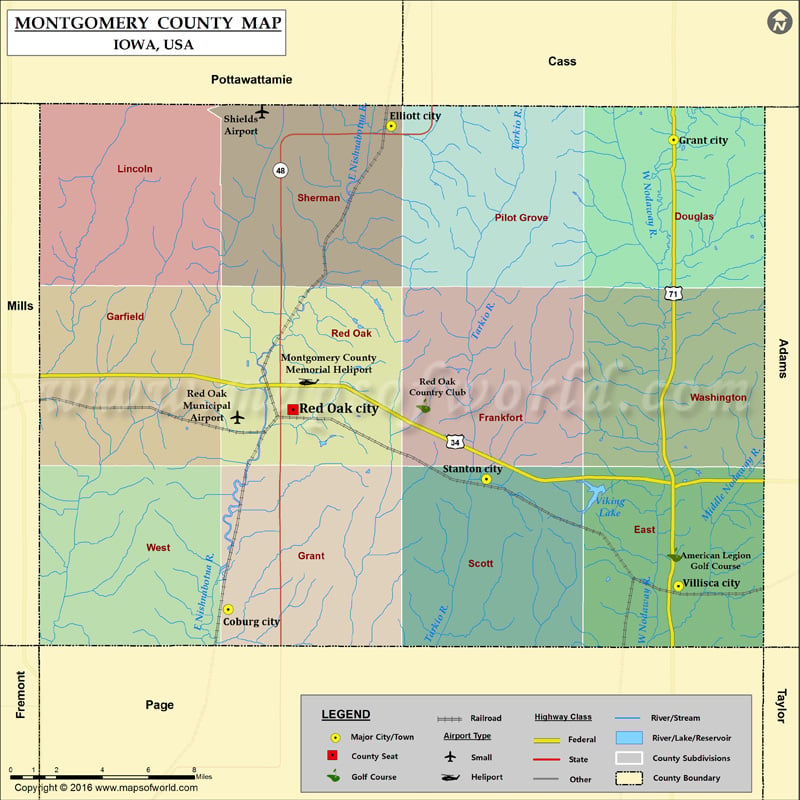
Airports in Montgomery County Airport Name Montgomery County Memorial Heliport Red Oak Municipal Airport Shields Airport More Maps of Montgomery County Montgomery County Map, Alabama Montgomery County Map, New York…
Airports in Montgomery County
Airport Name
Montgomery County Memorial Heliport
Red Oak Municipal Airport
Shields Airport
More Maps of Montgomery County
Cities in Montgomery County
City
Population
Latitude
Longitude
Coburg city
42
40.918789
-95.265552
Elliott city
350
41.149367
-95.162865
Grant city
92
41.142714
-94.985012
Red Oak city
5742
41.014148
-95.224825
Stanton city
689
40.981015
-95.102951
Villisca city
1252
40.929827
-94.981923
Golf Courses in Montgomery County
Name of Golf Course
Latitude
Longitude
American Legion Golf Course-Villisca
40.944928
-94.984636
Red Oak Country Club-Red Oak
41.015987
-95.142689

 Wall Maps