Mitchell County Map, Iowa
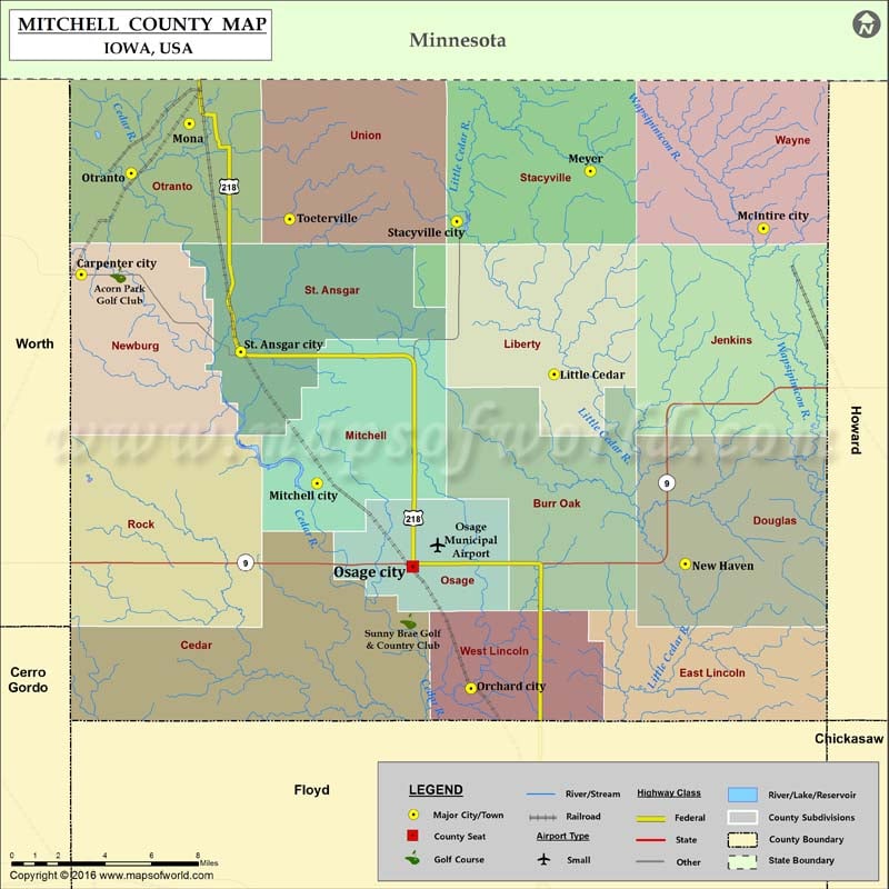
Airports in Mitchell County Airport Name Osage Municipal Airport More Maps of Mitchell County Mitchell County Map, North Carolina Mitchell County Map, Texas Mitchell County Map, Georgia Cities in Mitchell…
Airports in Mitchell County
Airport Name
Osage Municipal Airport
More Maps of Mitchell County
Cities in Mitchell County
City
Population
Latitude
Longitude
Carpenter city
109
43.414988
-93.017268
Little Cedar
60
43.369848
-92.723642
McIntire city
122
43.435961
-92.593685
Meyer
31
43.461813
-92.701063
Mitchell city
138
43.320421
-92.870873
Mona
34
43.483288
-92.95012
New Haven
91
43.283923
-92.642189
Orchard city
71
43.227386
-92.775313
Osage city
3619
43.282649
-92.811388
Otranto
27
43.460867
-92.98616
St. Ansgar city
1107
43.379992
-92.918196
Stacyville city
494
43.439031
-92.783977
Toeterville
48
43.440084
-92.887955
Golf Courses in Mitchell County
Name of Golf Course
Latitude
Longitude
Acorn Park Golf Club-St Ansgar
43.414933
-92.994334
Sunny Brae Golf & Country Club-Osage
43.258056
-92.814206

 Wall Maps