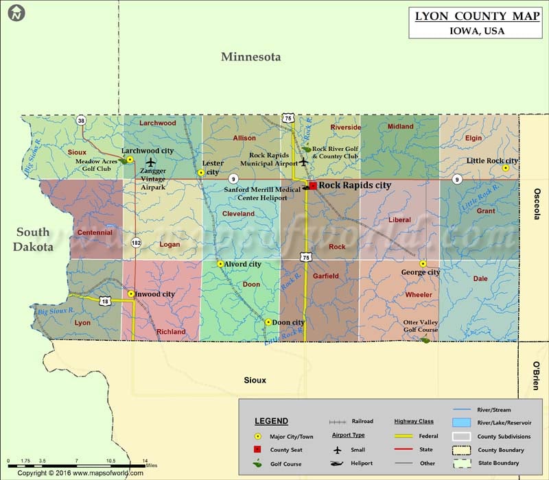
Airports in Lyon County Airport Name Rock Rapids Municipal Airport Sanford Merrill Medical Center Heliport Zangger Vintage Airpark Cities in Lyon County City Population Latitude Longitude Alvord city 196 43.341789…
Airports in Lyon County
Airport Name
Rock Rapids Municipal Airport
Sanford Merrill Medical Center Heliport
Zangger Vintage Airpark
Cities in Lyon County
City
Population
Latitude
Longitude
Alvord city
196
43.341789
-96.302594
Doon city
577
43.278785
-96.231749
George city
1080
43.341995
-96.002709
Inwood city
814
43.309297
-96.435079
Larchwood city
866
43.454424
-96.436837
Lester city
294
43.440299
-96.331437
Little Rock city
459
43.445435
-95.880437
Rock Rapids city
2549
43.425891
-96.165728
Golf Courses in Lyon County
Name of Golf Course
Latitude
Longitude
Meadow Acres Golf Club-Larchwood
43.45468
-96.44722
Otter Valley Golf Course-George
43.2612
-96.000214
Rock River Golf & Country Club-Rock Rapids
43.467404
-96.175438

 Wall Maps