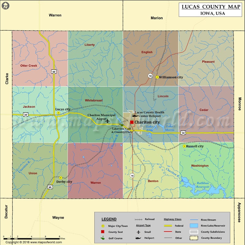
Iowa Counties Lucas County Map, Iowa Vishul MalikAugust 8, 202201.4K views Airports in Lucas County Airport Name Chariton Municipal Airport Lucas County Health Center Heliport Cities in Lucas County City Population Latitude Longitude Chariton city 4321 41.017575 -93.309449 Derby city 115… Buy Printed MapBuy Digital MapWall MapsCustomize Airports in Lucas County Airport Name Chariton Municipal Airport Lucas County Health Center Heliport Cities in Lucas County City Population Latitude Longitude Chariton city 4321 41.017575 -93.309449 Derby city 115 40.930336 -93.456483 Lucas city 216 41.032211 -93.461049 Russell city 554 40.980105 -93.200539 Williamson city 152 41.088242 -93.256882 Golf Courses in Lucas County Name of Golf Course Latitude Longitude Lakeview Golf & Country Club-Chariton 41.0149 -93.331294

 Wall Maps