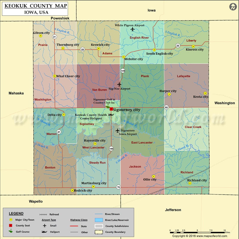
Airports in Keokuk County Airport Name Keokuk County Health Center Heliport Sig-Nor Airport Sigourney Iowa Airport White Pigeon Airport Cities in Keokuk County City Population Latitude Longitude Delta city 328…
Airports in Keokuk County
Airport Name
Keokuk County Health Center Heliport
Sig-Nor Airport
Sigourney Iowa Airport
White Pigeon Airport
Cities in Keokuk County
City
Population
Latitude
Longitude
Delta city
328
41.322588
-92.330421
Gibson city
61
41.480236
-92.392046
Harper city
114
41.363671
-92.050951
Hayesville city
50
41.26471
-92.2477
Hedrick city
764
41.171163
-92.307949
Keota city
1009
41.365499
-91.955435
Keswick city
246
41.454665
-92.238217
Kinross city
73
41.458877
-91.987303
Martinsburg city
112
41.178666
-92.251918
Ollie city
215
41.199148
-92.092306
Richland city
584
41.185709
-91.996025
Sigourney city
2059
41.334098
-92.204542
South English city
212
41.452083
-92.090512
Thornburg city
67
41.455395
-92.332761
Webster city
88
41.437877
-92.171515
What Cheer city
646
41.399756
-92.354626
Golf Courses in Keokuk County
Name of Golf Course
Latitude
Longitude
Sigourney Golf & Country Club Inc-Sigourney
41.33971
-92.214599

 Wall Maps