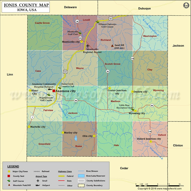
Mountain Peaks in Jones County Mountain Peak/Hill Elevation [Meter] Chimney Rock 258 More Maps of Jones County Jones County Map, South Dakota Jones County Map, Texas Jones County Map, Georgia…
Mountain Peaks in Jones County
Mountain Peak/Hill
Elevation [Meter]
Chimney Rock
258
More Maps of Jones County
Airports in Jones County
Airport Name
Anamosa Community Hospital Heliport
Monticello Regional Airport
Cities in Jones County
City
Population
Latitude
Longitude
Anamosa city
5533
42.109284
-91.275875
Center Junction city
111
42.115773
-91.090366
Martelle city
255
42.020444
-91.357764
Monticello city
3796
42.23042
-91.183729
Morley city
115
42.006028
-91.245872
Olin city
698
41.997611
-91.141717
Onslow city
197
42.107306
-91.015255
Oxford Junction city
496
41.983723
-90.954097
Stone City
192
42.110067
-91.354292
Wyoming city
515
42.059721
-91.00511
Golf Courses in Jones County
Name of Golf Course
Latitude
Longitude
Fawn Creek Country Club-Anamosa
42.1177
-91.256779
Fillmore Fairways Golf Course-Cascade
42.28048
-91.131239
Little Bear Recreation Club-Wyoming
42.06443
-91.014505
Monticello Golf Club-Monticello
42.253135
-91.189894
Wapsipinicon Golf Course-Anamosa
42.100449
-91.293152

 Wall Maps