
 Wall Maps
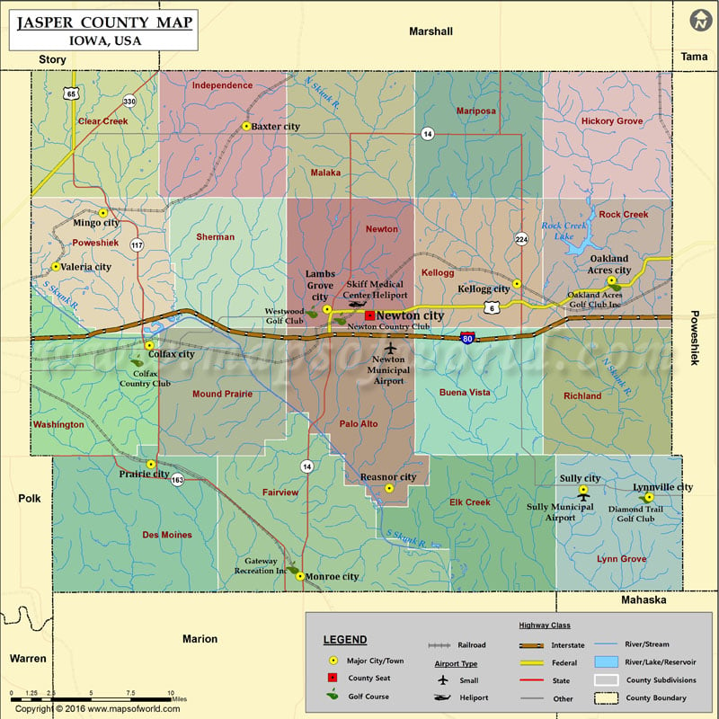
Airports in Jasper County
| Airport Name |
|---|
| Newton Municipal Airport |
| Skiff Medical Center Heliport |
| Sully Municipal Airport |
More Maps of Jasper County
Cities in Jasper County
| City | Population | Latitude | Longitude |
|---|---|---|---|
| Baxter city | 1101 | 41.8252 | -93.152455 |
| Colfax city | 2093 | 41.676085 | -93.240454 |
| Kellogg city | 599 | 41.718027 | -92.907079 |
| Lambs Grove city | 172 | 41.700753 | -93.079349 |
| Lynnville city | 379 | 41.572836 | -92.786891 |
| Mingo city | 302 | 41.766207 | -93.282619 |
| Monroe city | 1830 | 41.518937 | -93.103748 |
| Newton city | 15254 | 41.696528 | -93.040467 |
| Oakland Acres city | 156 | 41.720439 | -92.821163 |
| Prairie City city | 1680 | 41.595273 | -93.239159 |
| Reasnor city | 152 | 41.578854 | -93.022914 |
| Sully city | 821 | 41.578001 | -92.846801 |
| Valeria city | 57 | 41.72979 | -93.325566 |
Golf Courses in Jasper County
| Name of Golf Course | Latitude | Longitude |
|---|---|---|
| Colfax Country Club-Colfax | 41.665895 | -93.25176 |
| Diamond Trail Golf Club-Lynnville | 41.5729 | -92.790636 |
| Gateway Recreation Inc-Monroe | 41.524904 | -93.110755 |
| Newton Country Club-Newton | 41.694281 | -93.067774 |
| Oakland Acres Golf Club Inc-Grinnell | 41.717263 | -92.818117 |
| Westwood Golf Club-Newton | 41.69897 | -93.093452 |