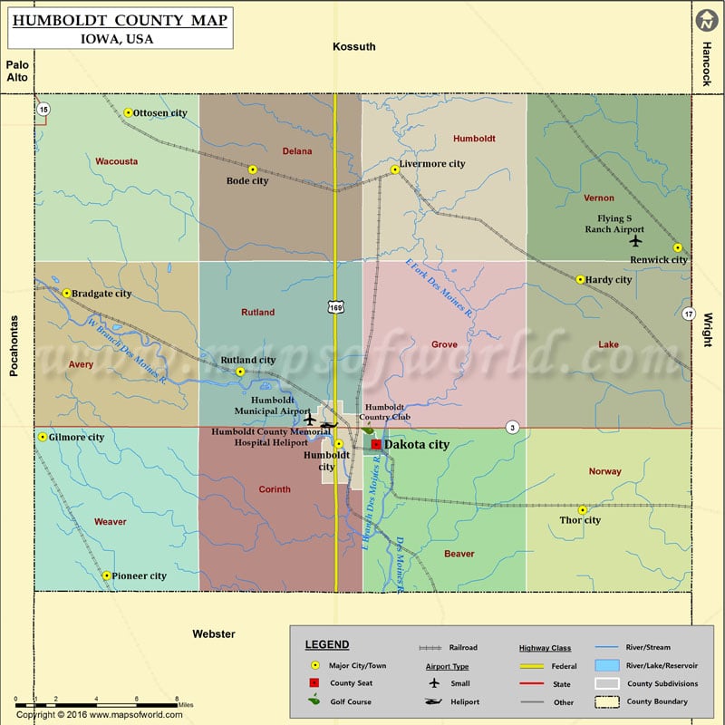
Humboldt County Map, Iowa
Airports in Humboldt County Airport Name Flying S Ranch Airport Humboldt County Memorial Hospital Heliport Humboldt Municipal Airport Cities in Humboldt County City Population Latitude Longitude Bode city 302 42.868027…
Airports in Humboldt County
Airport Name
Flying S Ranch Airport
Humboldt County Memorial Hospital Heliport
Humboldt Municipal Airport
Cities in Humboldt County
City
Population
Latitude
Longitude
Bode city
302
42.868027
-94.286242
Bradgate city
86
42.802877
-94.419624
Dakota City city
843
42.722903
-94.197692
Gilmore City city
504
42.7269
-94.436913
Hardy city
47
42.81015
-94.051145
Humboldt city
4690
42.723174
-94.224553
Livermore city
384
42.868031
-94.184042
Ottosen city
55
42.898088
-94.375547
Pioneer city
23
42.653525
-94.390892
Renwick city
242
42.826916
-93.981334
Rutland city
126
42.761434
-94.295189
Thor city
186
42.688116
-94.049569
Golf Courses in Humboldt County
Name of Golf Course
Latitude
Longitude
Humboldt Country Club-Humboldt
42.731623
-94.203889

 Wall Maps