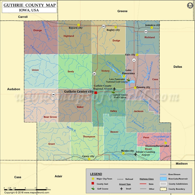
Airports in Guthrie County Airport Name Guthrie County Regional Airport Jukam’s Landing Airport Cities in Guthrie County City Population Latitude Longitude Bagley city 303 41.846364 -94.430305 Bayard city 471 41.851956…
Airports in Guthrie County
Airport Name
Guthrie County Regional Airport
Jukam’s Landing Airport
Cities in Guthrie County
City
Population
Latitude
Longitude
Bagley city
303
41.846364
-94.430305
Bayard city
471
41.851956
-94.557754
Casey city
426
41.50746
-94.521271
Diamondhead Lake
366
41.548886
-94.259251
Guthrie Center city
1569
41.678124
-94.498947
Jamaica city
224
41.845228
-94.306971
Lake Panorama
1309
41.71985
-94.402566
Menlo city
353
41.522145
-94.404251
Panora city
1124
41.69102
-94.3637
Yale city
246
41.775372
-94.357212
Golf Courses in Guthrie County
Name of Golf Course
Latitude
Longitude
Guthrie Center Golf Course-Guthrie Center
41.68049
-94.439574
Lake Panorama National Golf Course-Panora
41.711797
-94.387509

 Wall Maps