Franklin County Map, Iowa
Airports in Franklin County Airport Name Beeds Lake Airport Hampton Municipal Airport More Maps of Franklin County Franklin County Map, Vermont Franklin County Map, Nebraska Franklin County Map, Alabama Franklin…
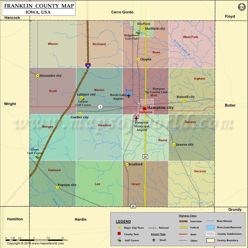
Airports in Franklin County
Airport Name
Beeds Lake Airport
Hampton Municipal Airport
More Maps of Franklin County
Franklin County Map, Vermont Franklin County Map, Nebraska Franklin County Map, Alabama Franklin County Map, Florida Franklin County Map, New York Franklin County Map, North Carolina Franklin County Map, Texas Franklin County Map, Tennessee Franklin County Map, Washington Franklin County Map, Georgia
Cities in Franklin County
City
Population
Latitude
Longitude
Alexander city
175
42.80442
-93.478647
Bradford
99
42.636706
-93.248948
Chapin
87
42.835312
-93.221982
Coulter city
281
42.73312
-93.370047
Geneva city
165
42.674798
-93.129766
Hampton city
4461
42.742006
-93.204966
Hansell city
98
42.75775
-93.104094
Latimer city
507
42.762884
-93.3656
Popejoy city
79
42.593881
-93.427823
Sheffield city
1172
42.89288
-93.208697
Golf Courses in Franklin County
Name of Golf Course
Latitude
Longitude
Dows Golf Course-Dows
42.652113
-93.48004
Hampton Country Club-Hampton
42.774458
-93.199088
Latimer Golf Course-Latimer
42.762065
-93.364549
Ridgestone Golf Club-Sheffield
42.88593
-93.221839

 Wall Maps