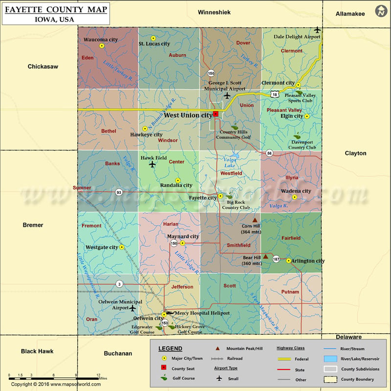
Mountain Peaks in Fayette County Mountain Peak/Hill Elevation [Meter] Bear Hill 360 Corn Hill 364 More Maps of Fayette County Fayette County Map, Alabama Fayette County Map, Texas Fayette County…
Mountain Peaks in Fayette County
Mountain Peak/Hill
Elevation [Meter]
Bear Hill
360
Corn Hill
364
More Maps of Fayette County
Airports in Fayette County
Airport Name
Dale Delight Airport
George L Scott Municipal Airport
Hawk Field
Mercy Hospital Heliport
Oelwein Municipal Airport
Cities in Fayette County
City
Population
Latitude
Longitude
Arlington city
429
42.748787
-91.671048
Clermont city
632
43.000163
-91.652312
Elgin city
683
42.955369
-91.635592
Fayette city
1338
42.841519
-91.803706
Hawkeye city
449
42.937742
-91.950354
Maynard city
518
42.773922
-91.877493
Oelwein city
6415
42.671367
-91.913195
Randalia city
68
42.863596
-91.886446
St. Lucas city
143
43.066694
-91.93418
Wadena city
262
42.839781
-91.6594
Waucoma city
257
43.055999
-92.034489
West Union city
2486
42.958892
-91.8132
Westgate city
211
42.768239
-91.995596
Golf Courses in Fayette County
Name of Golf Course
Latitude
Longitude
Big Rock Country Club-Fayette
42.841983
-91.786985
Country Hills Community Golf-West Union
42.94081
-91.77605
Davenport Country Club-Pleasant Valley
42.927875
-91.654694
Edgewater Golf Course-Oelwein
42.654171
-91.923269
Hickory Grove Golf Course-Oelwein
42.655356
-91.899007
Pleasant Valley Sports Club-Clermont
42.991365
-91.650685

 Wall Maps