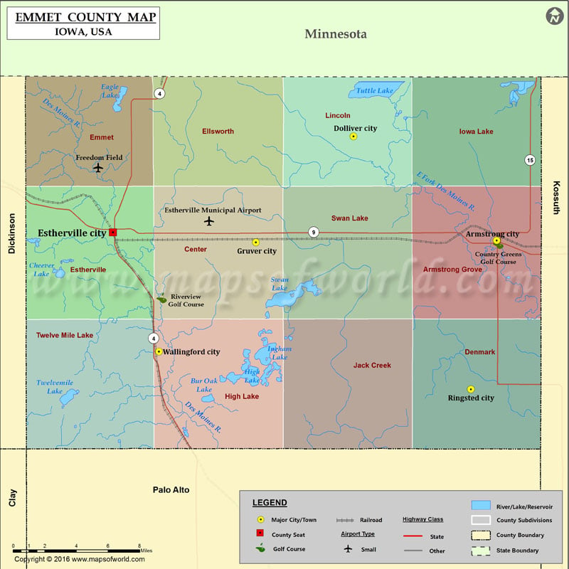
Iowa Counties Emmet County Map, Iowa Vishul MalikAugust 8, 202201.1K views Airports in Emmet County Airport Name Estherville Municipal Airport Freedom Field Cities in Emmet County City Population Latitude Longitude Armstrong city 926 43.394409 -94.483207 Dolliver city 66 43.463836 -94.614318 Estherville… Buy Printed MapBuy Digital MapWall MapsCustomize Airports in Emmet County Airport Name Estherville Municipal Airport Freedom Field Cities in Emmet County City Population Latitude Longitude Armstrong city 926 43.394409 -94.483207 Dolliver city 66 43.463836 -94.614318 Estherville city 6360 43.399797 -94.834517 Gruver city 94 43.393128 -94.703558 Ringsted city 422 43.294939 -94.506729 Wallingford city 197 43.320155 -94.792428 Golf Courses in Emmet County Name of Golf Course Latitude Longitude Country Greens Golf Course-Armstrong 43.39221 -94.481589 Riverview Golf Course-Estherville 43.356003 -94.789892

 Wall Maps