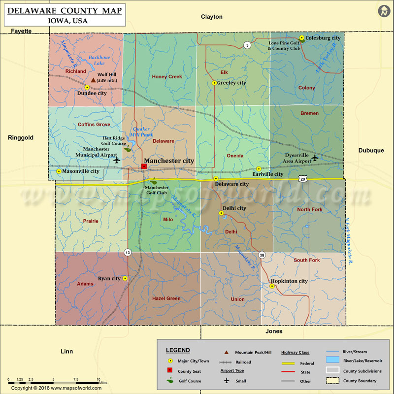
Delaware County Map, Iowa
Mountain Peaks in Delaware County Mountain Peak/Hill Elevation [Meter] Wolf Hill 339 More Maps of Delaware County Delaware County Map, New York Airports in Delaware County Airport Name Dyersville Area…
Mountain Peaks in Delaware County
Mountain Peak/Hill
Elevation [Meter]
Wolf Hill
339
More Maps of Delaware County
Airports in Delaware County
Airport Name
Dyersville Area Airport
Dyersville Area Airport
Manchester Municipal Airport
Cities in Delaware County
City
Population
Latitude
Longitude
Colesburg city
404
42.638796
-91.201004
Delaware city
159
42.471284
-91.339042
Delhi city
460
42.430242
-91.330538
Dundee city
174
42.579851
-91.546146
Earlville city
812
42.482755
-91.270107
Greeley city
256
42.585058
-91.341545
Hopkinton city
628
42.343122
-91.248661
Manchester city
5179
42.485766
-91.454757
Masonville city
127
42.479848
-91.591502
Ryan city
361
42.352409
-91.485139
Golf Courses in Delaware County
Name of Golf Course
Latitude
Longitude
Hart Ridge Golf Course-Manchester
42.507091
-91.481255
Lone Pine Golf & Country Club-Colesburg
42.636999
-91.201338
Manchester Golf Club-Manchester
42.468403
-91.439496

 Wall Maps