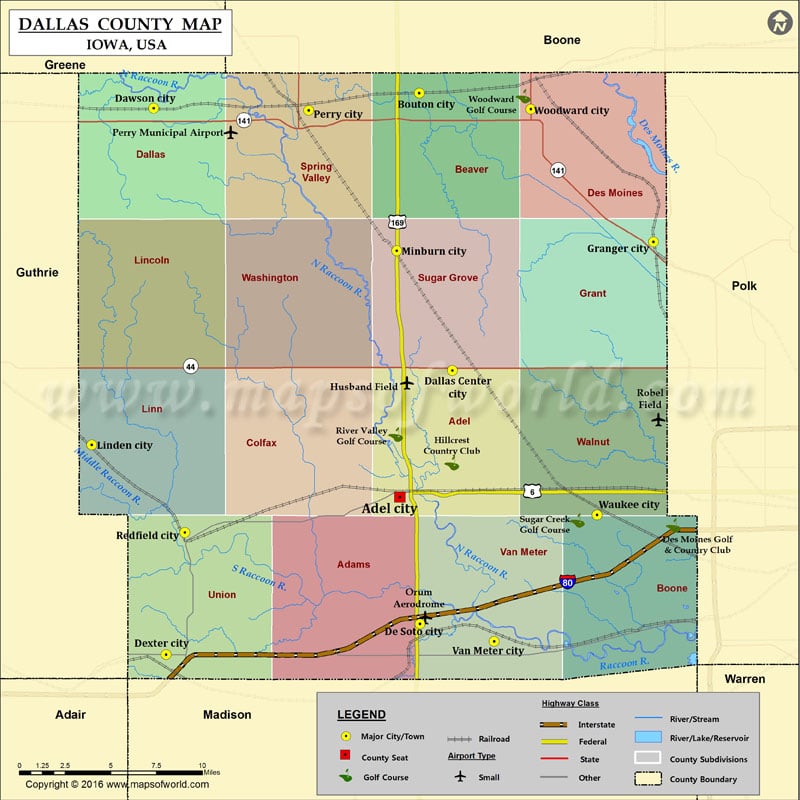
Airports in Dallas County Airport Name Husband Field Orum Aerodrome Perry Municipal Airport Robel Field More Maps of Dallas County Dallas County Map, Alabama Dallas County Map, Texas Cities in…
Airports in Dallas County
Airport Name
Husband Field
Orum Aerodrome
Perry Municipal Airport
Robel Field
More Maps of Dallas County
Cities in Dallas County
City
Population
Latitude
Longitude
Adel city
3682
41.61155
-94.025928
Bouton city
129
41.851315
-94.010415
Dallas Center city
1623
41.686785
-93.984292
Dawson city
131
41.842381
-94.220875
De Soto city
1050
41.536179
-94.009863
Dexter city
611
41.517905
-94.21101
Granger city
1244
41.763061
-93.825001
Linden city
199
41.642642
-94.269885
Minburn city
365
41.757842
-94.028361
Perry city
7702
41.841096
-94.09804
Redfield city
835
41.590604
-94.196112
Van Meter city
1016
41.525788
-93.951288
Waukee city
13790
41.601001
-93.869616
Woodward city
1024
41.841705
-93.92218
Golf Courses in Dallas County
Name of Golf Course
Latitude
Longitude
Des Moines Golf & Country Club-West Des Moines
41.59472
-93.809226
Hillcrest Country Club-Adel
41.631745
-93.984585
River Valley Golf Course-Adel
41.648701
-94.029128
Sugar Creek Golf Course-Waukee
41.597686
-93.885304
Woodward Golf Course-Woodward
41.849452
-93.928277

 Wall Maps