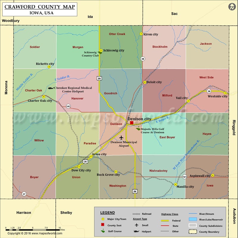
Crawford County Map, Iowa
Airports in Crawford County Airport Name Cherokee Regional Medical Center Heliport Denison Municipal Airport More Maps of Crawford County Crawford County Map, Wisconsin Crawford County Map, Georgia Cities in Crawford…
Airports in Crawford County
Airport Name
Cherokee Regional Medical Center Heliport
Denison Municipal Airport
More Maps of Crawford County
Cities in Crawford County
City
Population
Latitude
Longitude
Arion city
108
41.948161
-95.462322
Aspinwall city
40
41.910549
-95.134961
Buck Grove city
43
41.917825
-95.395105
Charter Oak city
502
42.068253
-95.589172
Deloit city
264
42.097142
-95.317464
Denison city
8298
42.016009
-95.352807
Dow City city
510
41.927998
-95.494346
Kiron city
279
42.19413
-95.327268
Manilla city
776
41.892309
-95.234561
Ricketts city
145
42.12809
-95.574904
Schleswig city
882
42.160717
-95.435225
Vail city
436
42.059822
-95.20032
Westside city
299
42.075749
-95.101348
Golf Courses in Crawford County
Name of Golf Course
Latitude
Longitude
Majestic Hills Golf Course At Denison-Denison
42.0052
-95.335569
Schleswig Country Club-Schleswig
42.158072
-95.4385

 Wall Maps