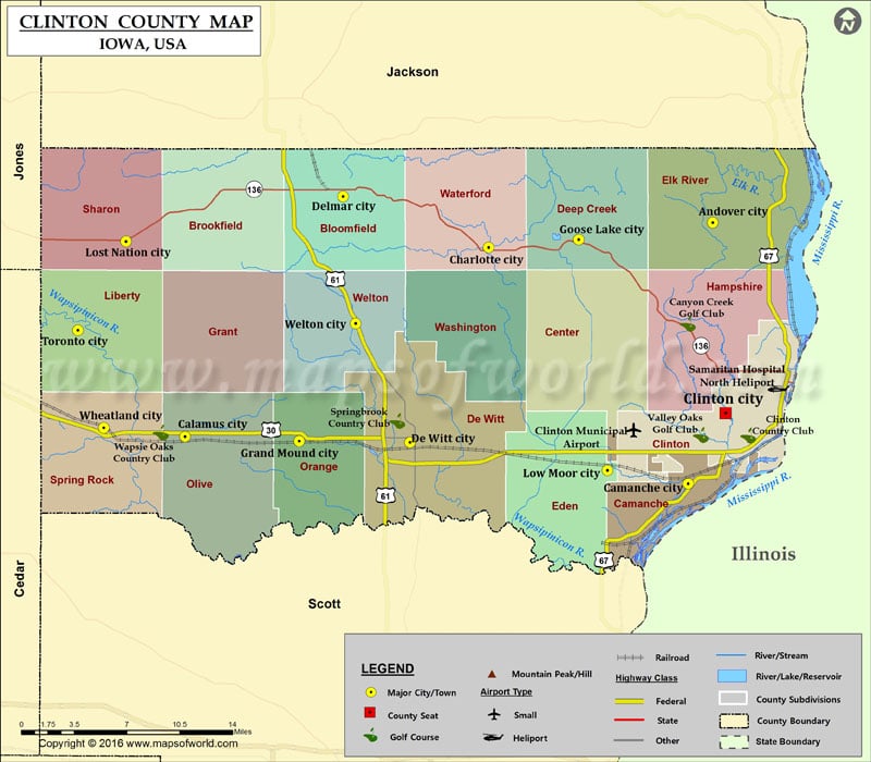
Airports in Clinton County Airport Name Clinton Municipal Airport Samaritan Hospital North Heliport More Maps of Clinton County Clinton County Map, New York Cities in Clinton County City Population Latitude…
Airports in Clinton County
Airport Name
Clinton Municipal Airport
Samaritan Hospital North Heliport
More Maps of Clinton County
Cities in Clinton County
City
Population
Latitude
Longitude
Andover city
103
41.979923
-90.252985
Calamus city
439
41.826494
-90.760015
Camanche city
4448
41.792759
-90.276678
Charlotte city
394
41.96213
-90.468206
Clinton city
26885
41.843436
-90.240789
De Witt city
5322
41.822417
-90.543844
Delmar city
525
41.998801
-90.607968
Goose Lake city
240
41.967883
-90.381762
Grand Mound city
642
41.823271
-90.650158
Lost Nation city
446
41.966599
-90.816717
Low Moor city
288
41.802344
-90.354213
Toronto city
124
41.902889
-90.862757
Welton city
165
41.90768
-90.596095
Wheatland city
764
41.832892
-90.837872
Golf Courses in Clinton County
Name of Golf Course
Latitude
Longitude
Canyon Creek Golf Club-Clinton
41.907448
-90.276874
Clinton Country Club-Clinton
41.82732
-90.218991
Springbrook Country Club-de Witt
41.837681
-90.556012
Valley Oaks Golf Club-Clinton
41.827688
-90.264257
Wapsie Oaks Country Club-Calamus
41.829547
-90.783164

 Wall Maps