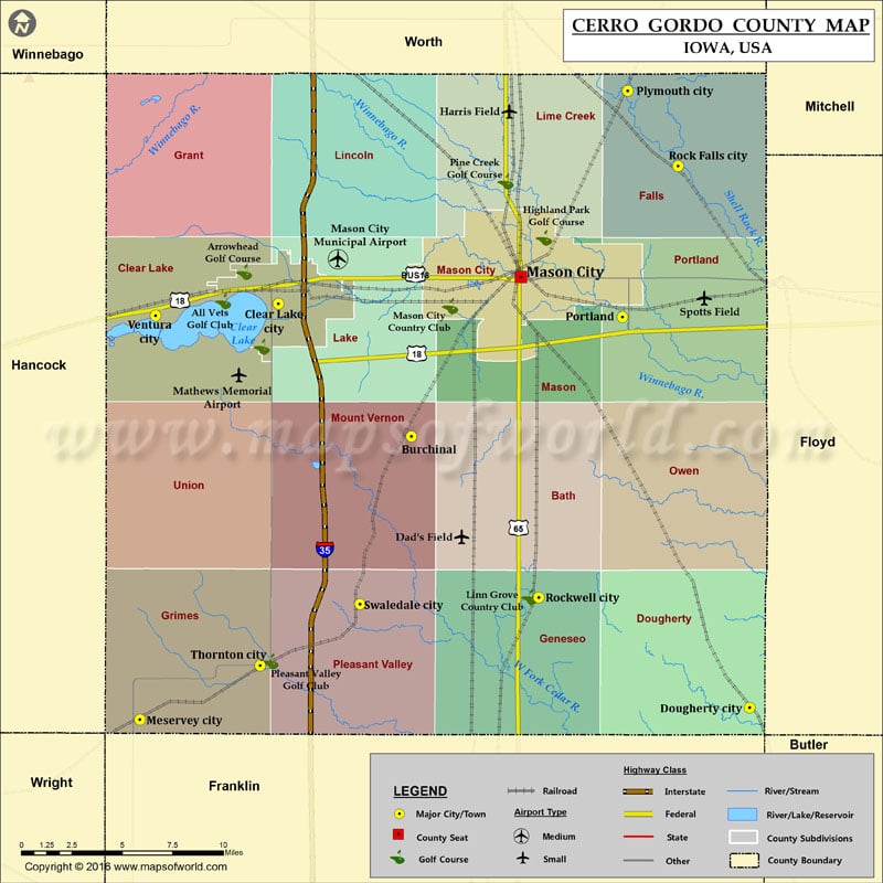
Cerro Gordo County Map, Iowa
Airports in Cerro Gordo County Airport Name Dad’s Field Harris Field Lloyd’s Field Mason City Municipal Airport Spotts Field Cities in Cerro Gordo County City Population Latitude Longitude Burchinal 40…
Airports in Cerro Gordo County
Airport Name
Dad’s Field
Harris Field
Lloyd’s Field
Mason City Municipal Airport
Spotts Field
Cities in Cerro Gordo County
City
Population
Latitude
Longitude
Burchinal
40
43.064797
-93.278516
Clear Lake city
7777
43.134654
-93.373992
Dougherty city
58
42.921966
-93.035883
Mason City city
28079
43.14872
-93.199807
Meservey city
256
42.915644
-93.473385
Plymouth city
382
43.246434
-93.123244
Portland
35
43.127574
-93.127119
Rock Falls city
155
43.206988
-93.087155
Rockwell city
1039
42.979966
-93.187127
Swaledale city
165
42.976524
-93.31547
Thornton city
422
42.944207
-93.387069
Ventura city
717
43.128334
-93.462104
Golf Courses in Cerro Gordo County
Name of Golf Course
Latitude
Longitude
All Vets Golf Club-Clear Lake
43.135987
-93.413571
Arrowhead Golf Course-Clear Lake
43.151305
-93.398564
Highland Park Golf Course-Mason City
43.169266
-93.183433
Linn Grove Country Club-Rockwell
42.980254
-93.193873
Mason City Country Club-Mason City
43.133289
-93.25071
Oak Hills Golf Course-Clear Lake
43.112064
-93.385897
Pine Creek Golf Course-Mason City
43.198903
-93.210839
Pleasant Valley Golf Club-Thornton
42.94633
-93.379564

 Wall Maps