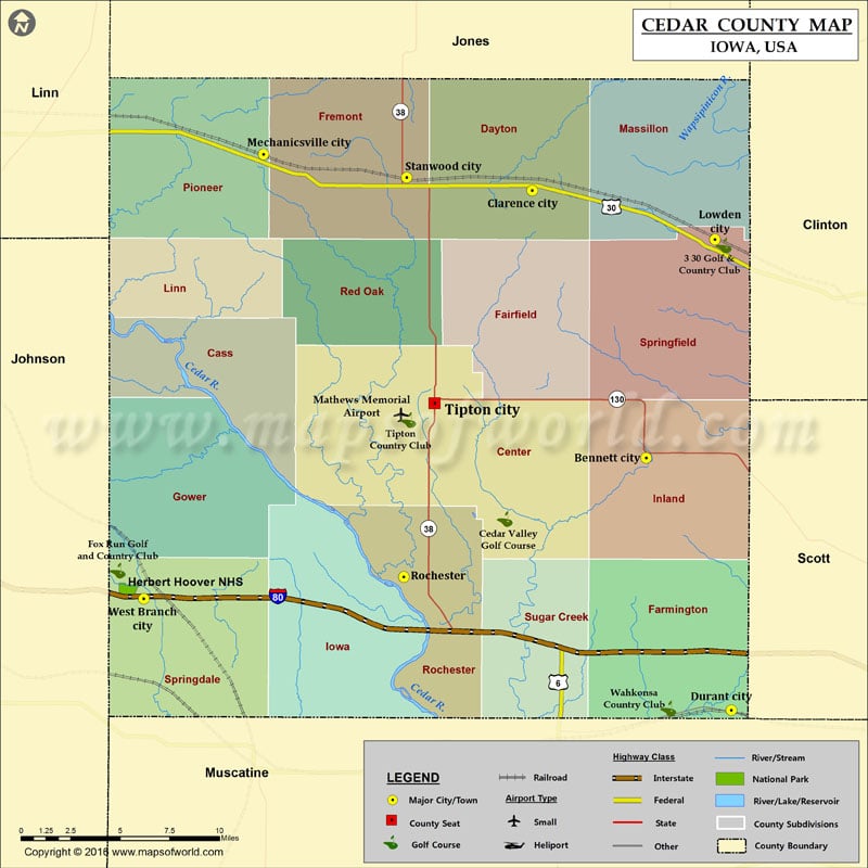
Airports in Cedar County Airport Name Mathews Memorial Airport More Maps of Cedar County Cedar County Map, Nebraska Cities in Cedar County City Population Latitude Longitude Bennett city 405 41.739829…
Airports in Cedar County
Airport Name
Mathews Memorial Airport
More Maps of Cedar County
Cities in Cedar County
City
Population
Latitude
Longitude
Bennett city
405
41.739829
-90.973842
Clarence city
974
41.885888
-91.057044
Durant city
1832
41.601728
-90.91166
Lowden city
789
41.859101
-90.923698
Mechanicsville city
1146
41.905572
-91.253246
Rochester
133
41.674781
-91.150876
Stanwood city
684
41.89304
-91.148771
Tipton city
3221
41.76979
-91.128372
West Branch city
2322
41.662765
-91.340661
Golf Courses in Cedar County
Name of Golf Course
Latitude
Longitude
3 30 Golf & Country Club-Lowden
41.85589
-90.917396
Cedar Valley Golf Course-Tipton
41.706413
-91.077018
Fox Run Golf and Country Club-West Branch
41.678154
-91.359675
Tipton Country Club-Tipton
41.760425
-91.147569
Wahkonsa Country Club-Durant
41.60259
-90.957756
National Parks in Cedar County
Name of Park
Latitude
Longitude
Herbert Hoover NHS
41.667944
-91.352372

 Wall Maps