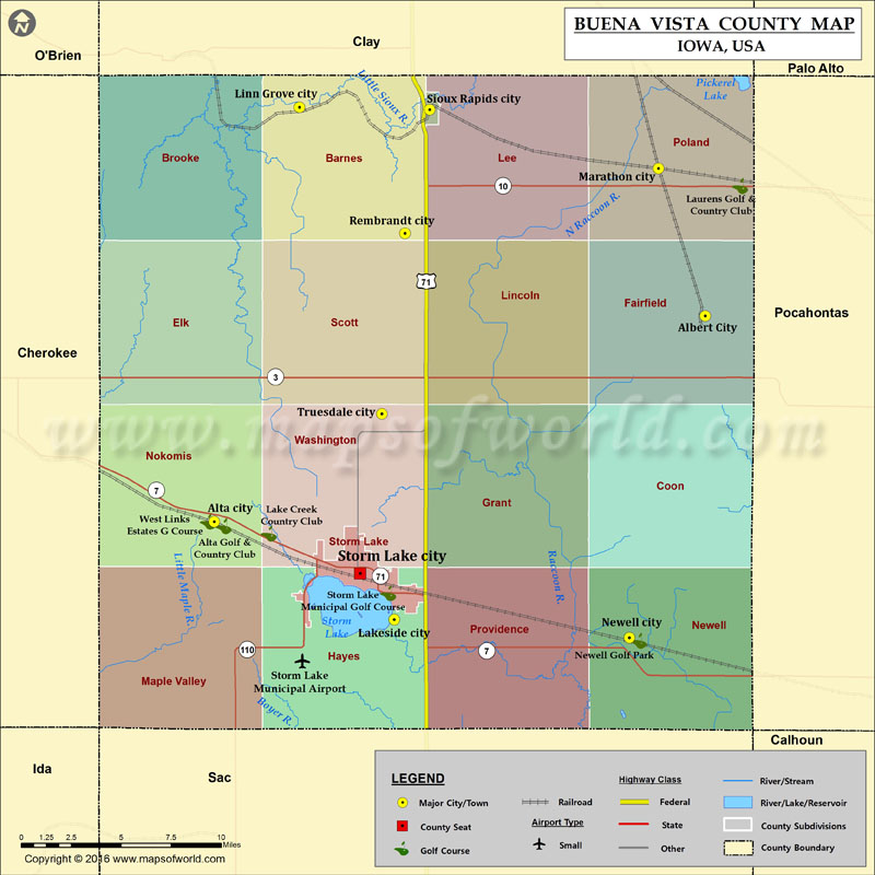
Buena Vista County Map, Iowa
Airports in Buena Vista County Airport Name Storm Lake Municipal Airport Cities in Buena Vista County City Population Latitude Longitude Albert City city 699 42.781595 -94.949029 Alta city 1883…
Airports in Buena Vista County
Airport Name
Storm Lake Municipal Airport
Cities in Buena Vista County
City
Population
Latitude
Longitude
Albert City city
699
42.781595
-94.949029
Alta city
1883
42.67169
-95.304529
Lakeside city
596
42.619388
-95.174187
Linn Grove city
154
42.892773
-95.242761
Marathon city
237
42.860269
-94.982869
Newell city
876
42.609762
-95.00396
Rembrandt city
203
42.825723
-95.166345
Sioux Rapids city
775
42.891559
-95.148613
Storm Lake city
10600
42.644082
-95.199002
Truesdale city
81
42.729308
-95.183125
Golf Courses in Buena Vista County
Name of Golf Course
Latitude
Longitude
Alta Golf & Country Club-Alta
42.6694
-95.297789
Lake Creek Country Club-Storm Lake
42.665363
-95.265054
Laurens Golf & Country Club-Laurens
42.850834
-94.923749
Newell Golf Park-Newell
42.608042
-94.997225
Storm Lake Municipal Golf Course-Storm Lake
42.633574
-95.178639
West Links Estates G Course-Alta
42.671716
-95.309162

 Wall Maps