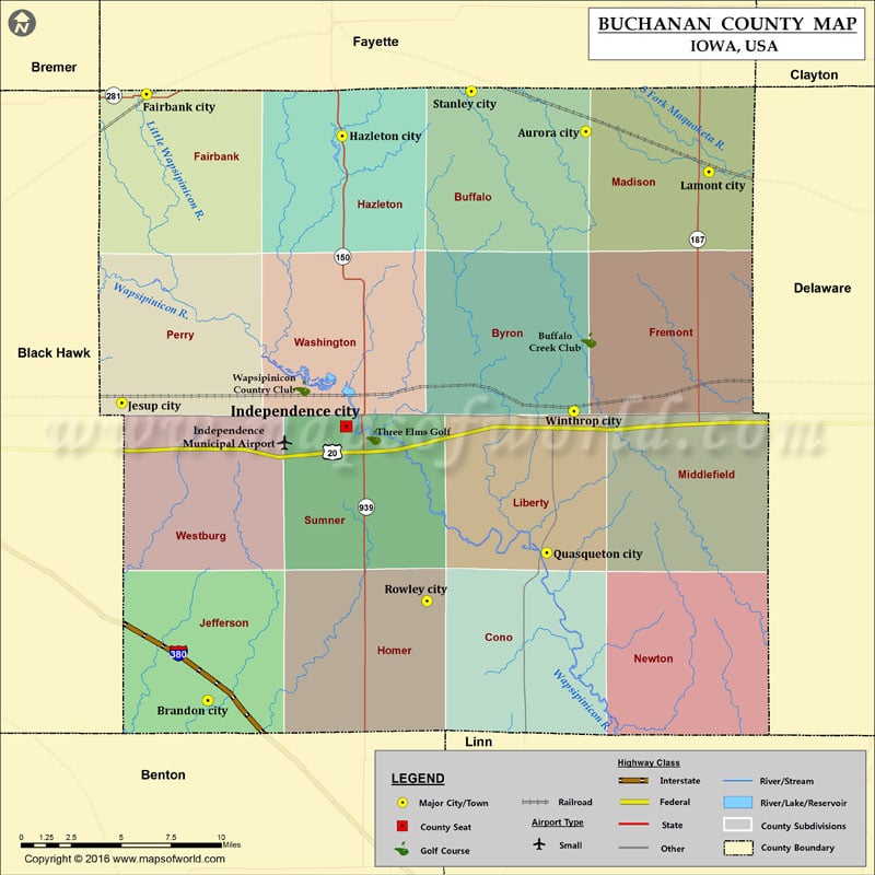
Buchanan County Map, Iowa
Airports in Buchanan County Airport Name Independence Municipal Airport Cities in Buchanan County City Population Latitude Longitude Aurora city 185 42.620108 -91.729452 Brandon city 309 42.315034 -92.003222 Fairbank city…
Airports in Buchanan County
Airport Name
Independence Municipal Airport
Cities in Buchanan County
City
Population
Latitude
Longitude
Aurora city
185
42.620108
-91.729452
Brandon city
309
42.315034
-92.003222
Fairbank city
1113
42.640104
-92.04757
Hazleton city
823
42.617746
-91.90584
Independence city
5966
42.462166
-91.902977
Jesup city
2520
42.474816
-92.065609
Lamont city
461
42.598565
-91.640427
Quasqueton city
554
42.394354
-91.757873
Rowley city
264
42.368488
-91.844496
Stanley city
125
42.641649
-91.81231
Winthrop city
850
42.470244
-91.738025
Golf Courses in Buchanan County
Name of Golf Course
Latitude
Longitude
Buffalo Creek Club-Winthrop
42.508573
-91.727344
Three Elms Golf-Independence
42.456349
-91.88317
Wapsipinicon Country Club-Independence
42.482854
-91.934693