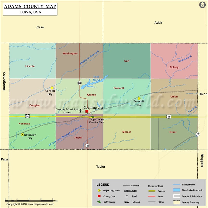
Iowa Counties Adams County Map, Iowa Vishul MalikOctober 25, 202201.2K views Airports in Adams County Airport Name Corning Municipal Airport More Maps of Adam County Adams County Map, Wisconsin Adams County Map, Nebraska Adams County Map, Washington Cities in Adams County… Buy Printed MapBuy Digital MapWall MapsCustomize Airports in Adams County Airport Name Corning Municipal Airport More Maps of Adam County Adams County Map, Wisconsin Adams County Map, Nebraska Adams County Map, Washington Cities in Adams County City Population Latitude Longitude Carbon City 34 41.049661 -94.824003 Corning city 1635 40.992908 -94.739487 Nodaway city 114 40.936549 -94.895383 Prescott city 257 41.023804 -94.61298 Golf Courses in Adams County Name of Golf Course Latitude Longitude Happy Hollow Country Club-Corning 40.981289 -94.726225

 Wall Maps