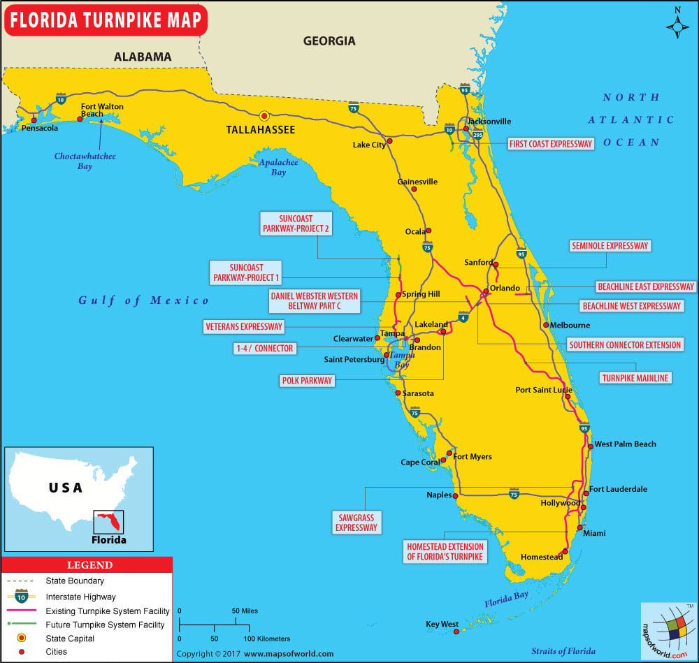
Florida Turnpike Map – It is known as State Road 91 and the Ronald Reagan Turnpike, is a toll road in the state of Florida. spanning approximately 309 miles along a north–south axis.
Florida Turnpike Map
Florida Turnpike Map – It is known as State Road 91 and the Ronald Reagan Turnpike, is a toll road in the state of Florida. spanning approximately 309 miles along…


 Wall Maps