Sumter County Map, Florida
Check this Florida County Map to locate all the state’s counties in Florida Map. Airports in Sumter County Airport Name Cheryl-Lane Landings Airport Connell’s Wahoo Airport Flying W Airranch Airport Freeflight International Airport…
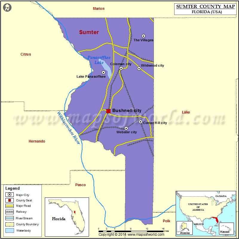
Check this Florida County Map to locate all the state’s counties in Florida Map .
Airports in Sumter County
Airport Name
Cheryl-Lane Landings Airport
Connell’s Wahoo Airport
Flying W Airranch Airport
Freeflight International Airport
Grass Patch Airport
Ko-Kee Airport
Montgomery’s Flying M Ranch Airport
S & S Avion Ranch Airport
More Maps of Sumter County
Cities in Sumter County
City
Population
Latitude
Longitude
Bushnell city
2418
28.665159
-82.115391
Center Hill City
988
28.63202
-82.00025
Coleman city
703
28.801222
-82.069704
Lake Panasoffkee
3551
28.787753
-82.132267
The Villages
51442
28.902922
-81.988673
Webster City
785
28.611496
-82.051042
Wildwood city
6709
28.79946
-82.004935
Golf Courses in Sumter County
Name of Golf Course
Latitude
Longitude
Cane Gardens Golf Course-Lady Lake
28.883706
-81.995512
Continental Country Club-Wildwood
28.822585
-81.987086
Glenview Championship Country Club-The Villages
28.949373
-82.006493
Hacienda Hills Golf & Country Club-The Villages
28.944251
-81.963699
Havana Country Club-Lady Lake
28.895304
-81.967345
Mallory Hills Golf Course-Lady Lake
28.896847
-81.972801
Miona Lake Golf Club-Wildwood
28.896945
-82.014989
Palmer Legends Country Club-The Villages
28.910224
-81.993607
Shady Brook Golf & RV-Sumterville
28.758054
-82.061373
The Villages Executive Golf Trail-Lady Lake
28.934795
-81.967252
Tierra Del Sol Golf & Country Club-The Villages
28.934955
-81.970252

 Wall Maps