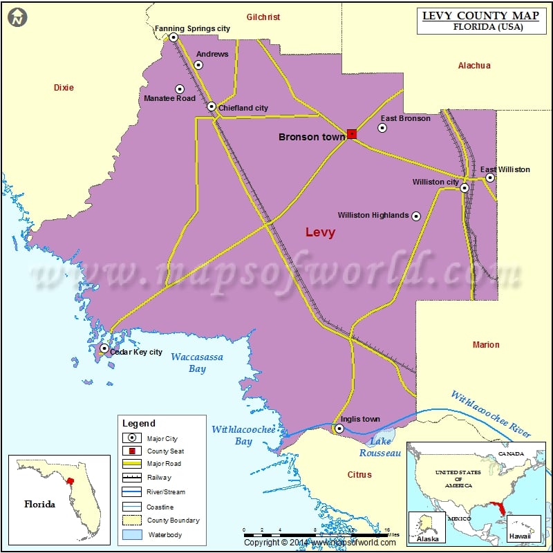
Check this Florida County Map to locate all the state’s counties in Florida Map. Mountain Peaks in Levy County Mountain Peak/Hill Elevation [Meter] Hodgson Hill 11 Shell Mound 4 Spring Hill 41 Airports…
Check this Florida County Map to locate all the state’s counties in Florida Map .
Mountain Peaks in Levy County
Mountain Peak/Hill
Elevation [Meter]
Hodgson Hill
11
Shell Mound
4
Spring Hill
41
Airports in Levy County
Airport Name
Ames Field
Brookins Air Strip
Chiefland Sky Ranch Airport
George T Lewis Airport
Neal Field
Randolph Air Force Base Auxiliary Airport
Redtail Airstrip
The Cedars Airfield
White Farms Airport
Williston Memorial Hospital Heliport
Williston Municipal Airport
Wings Field
Cities in Levy County
City
Population
Latitude
Longitude
Andrews
798
29.548176
-82.887998
Bronson town
1113
29.449901
-82.639208
Cedar Key city
702
29.145247
-83.038469
Chiefland city
2245
29.489522
-82.866488
East Bronson
1945
29.459297
-82.590537
East Williston
694
29.388354
-82.416478
Fanning Springs city
764
29.586979
-82.928468
Inglis town
1325
29.032706
-82.659193
Manatee Road
2244
29.514458
-82.918198
Morriston
164
29.281127
-82.440031
Otter Creek town
134
29.323999
-82.77366
Raleigh
373
29.447868
-82.468078
Williston city
2768
29.373621
-82.457574
Williston Highlands
2275
29.333616
-82.535656
Yankeetown town
502
29.028828
-82.761371
Golf Courses in Levy County
Name of Golf Course
Latitude
Longitude
Chiefland Golf & Country Club-Chiefland
29.496195
-82.93465
Williston Highlands Golf & Country Club-Williston
29.342733
-82.511457

 Wall Maps