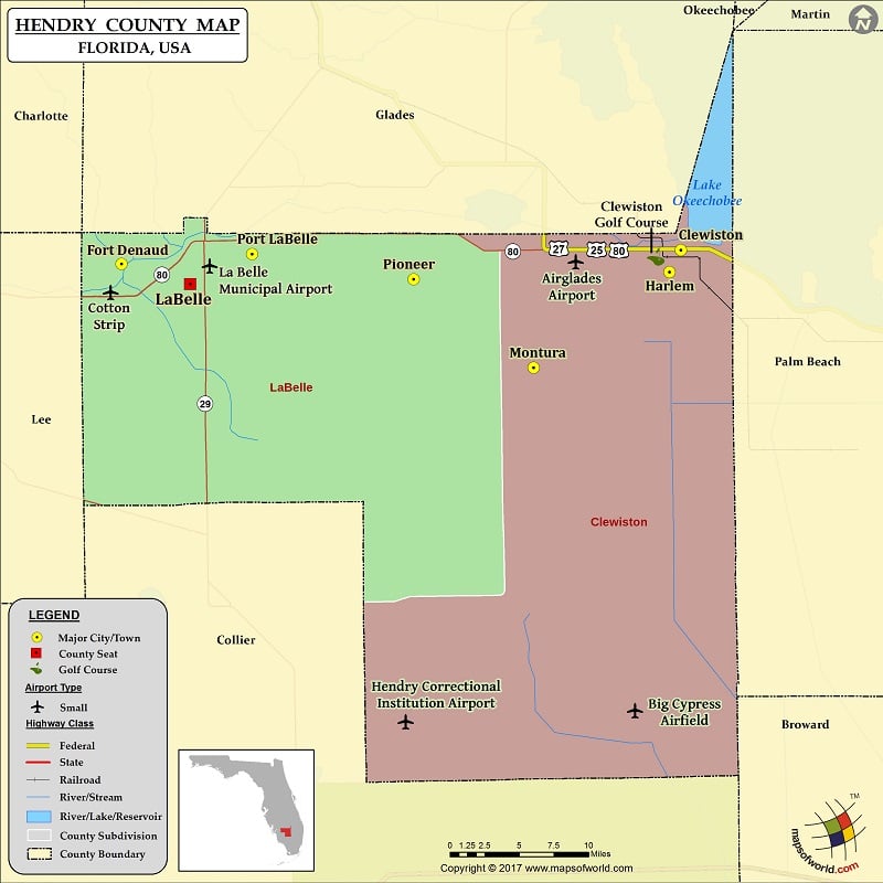
Hendry County Map, Florida
Check this Florida County Map to locate all the state’s counties in Florida Map. Mountain Peaks in Hendry County Mountain Peak/Hill Elevation [Meter] Maple Mound 6 Tonys Mound 5 Airports in Hendry County…
Check this Florida County Map to locate all the state’s counties in Florida Map .
Mountain Peaks in Hendry County
Mountain Peak/Hill
Elevation [Meter]
Maple Mound
6
Tonys Mound
5
Airports in Hendry County
Airport Name
Airglades Airport
Berry Grove Airport
Big Cypress Airfield
Bob Paul Airport
Charlton Strip
Colony Heliport
Cotton Strip
Duda Airstrip
Harper’s Fly-In Ranch Airport
Hendry Correctional Institution Airport
Hendry County Fire-Ems Heliport
La Belle Municipal Airport
Mc Daniel Ranch Inc. Airport
South Point Airport
Southern Ranch Airport
Strayhorn Ranch Airport
William’s Sky Manor Airport
Cities in Hendry County
City
Population
Latitude
Longitude
Clewiston city
7155
26.7532
-80.939907
Fort Denaud
1694
26.740247
-81.524146
Harlem
2658
26.732435
-80.951848
LaBelle city
4640
26.721227
-81.452532
Montura
3283
26.64283
-81.093739
Pioneer
697
26.725842
-81.21896
Port LaBelle
3530
26.749339
-81.387713
Golf Courses in Hendry County
Name of Golf Course
Latitude
Longitude
Clewiston Golf Course-Clewiston
26.74684
-80.951079

 Wall Maps