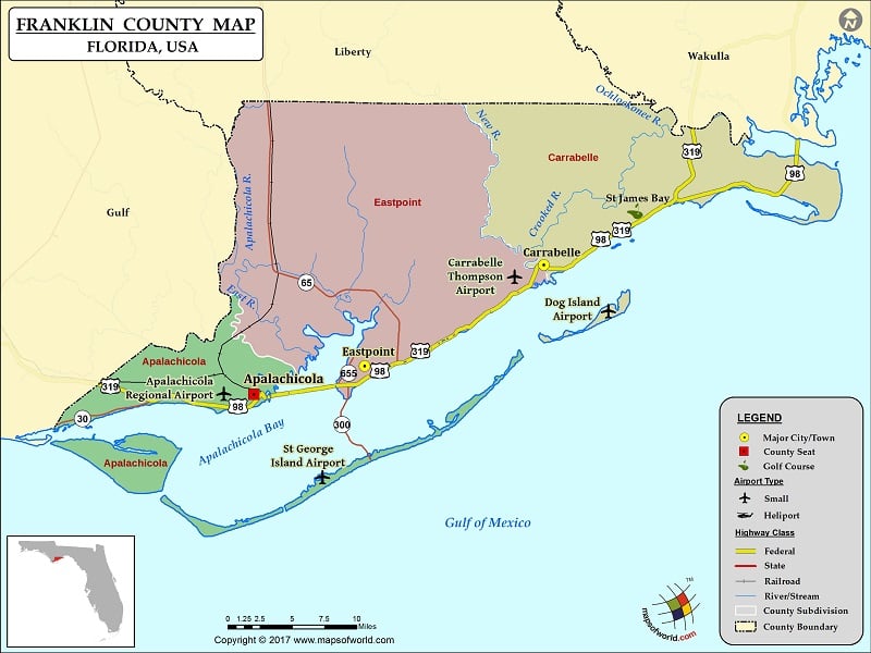
Franklin County Map, Florida
Check this Florida County Map to locate all the state’s counties in Florida Map. Mountain Peaks in Franklin County Mountain Peak/Hill Elevation [Meter] Southern Dunes 2 Sugar Hill 2 More Maps of Franklin…
Check this Florida County Map to locate all the state’s counties in Florida Map .
Mountain Peaks in Franklin County
Mountain Peak/Hill
Elevation [Meter]
Southern Dunes
2
Sugar Hill
2
More Maps of Franklin County
Airports in Franklin County
Airport Name
Apalachicola Regional Airport
Carrabelle Thompson Airport
Dog Island Airport
St George Island Airport
Cities in Franklin County
City
Population
Latitude
Longitude
Apalachicola city
2231
29.727093
-84.993789
Carrabelle city
2778
29.853791
-84.668341
Eastpoint
2337
29.754731
-84.869418
Golf Courses in Franklin County
Name of Golf Course
Latitude
Longitude
St James Bay-Carrabelle
29.904142
-84.563148

 Wall Maps