Columbia County Map, Florida
Check this Florida County Map to locate all the state’s counties in Florida Map. Airports in Columbia County Airport Name Aldine Heliport Cannon Creek Airpark Gladney Airport Hill Landing Strip Lake City Airpark…
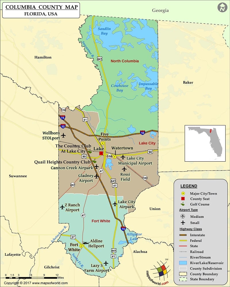
Check this Florida County Map to locate all the state’s counties in Florida Map .
Airports in Columbia County
Airport Name
Aldine Heliport
Cannon Creek Airpark
Gladney Airport
Hill Landing Strip
Lake City Airpark
Lake City Medical Center Heliport
Lake City Municipal Airport
Lake Shore Hospital Heliport
Lazy S Farm Airport
Rossi Field
Wellborn STOLport
Z Ranch Airport
More Maps of Columbia County
Cities in Columbia County
City
Population
Latitude
Longitude
Five Points
1265
30.222472
-82.646379
Fort White town
567
29.922408
-82.713555
Lake City city
12046
30.189198
-82.646904
Watertown
2829
30.185443
-82.602434
Golf Courses in Columbia County
Name of Golf Course
Latitude
Longitude
Quail Heights Country Club-Lake City
30.168946
-82.675803
The Country Club At Lake City-Lake City
30.195163
-82.691393

 Wall Maps