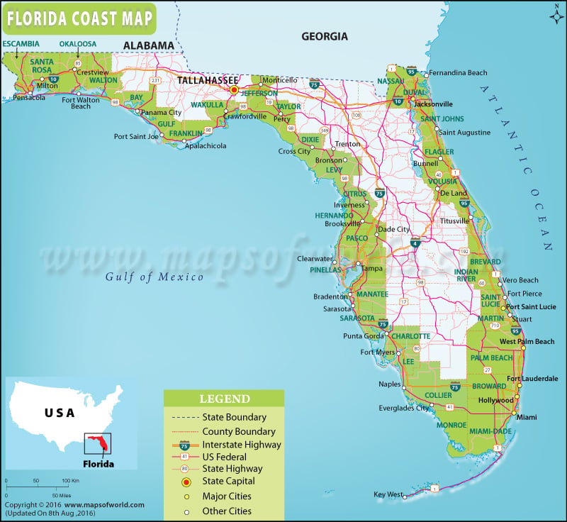
Florida Coast
With over 1,350 miles, the state of Florida has the longest coastline in the United States except Alaska. From the warm curves with glowing white sands along the Gulf of Mexico to glamorously inviting stretches of sand along the Atlantic Ocean, the coastline of Florida is as good as it gets in America. Tropical weather, year-round warm water temperatures, coastal scenery, and delicious cuisine make the ‘Sunshine State’ an ideal beach destination.
Be it Emerald Coast or Gold Coast, beaches in Florida offer endless entertainment and recreational pursuits. It is the only state in the contiguous US where both sunrise and sunset over a sea can be seen in a day. While the Gulf Coast lies in the Northwest and Southwest Florida, the Atlantic Coast (also known as the East Coast) extends along Northeast, Central, and Southeast Florida.
Gulf Coast of Florida
-
Emerald Coast
-
Forgotten Coast
-
Big Bend Coast
-
Nature Coast
-
Florida Suncoast
Atlantic Coast of Florida:
-
First Coast
-
Halifax area (Surf Coast)
-
Space Coast
-
Treasure Coast
-
Gold Coast
Major cities along the Gulf Coast
-
Tampa
-
St. Petersburg
-
Pensacola
-
Sarasota
-
Panama City
-
Fort Myers
Major cities along the East Coast
-
Jacksonville
-
Daytona Beach
-
Palm Beach
-
Miami
Beaches in Florida
-
South Beach, Florida
-
Siesta Key Beach, Florida
-
Destin Beach, Florida
-
Naples Beach, Florida
-
Clearwater Beach, Florida
-
Panama City Beach, Florida
-
West Palm Beach, Florida

 Wall Maps