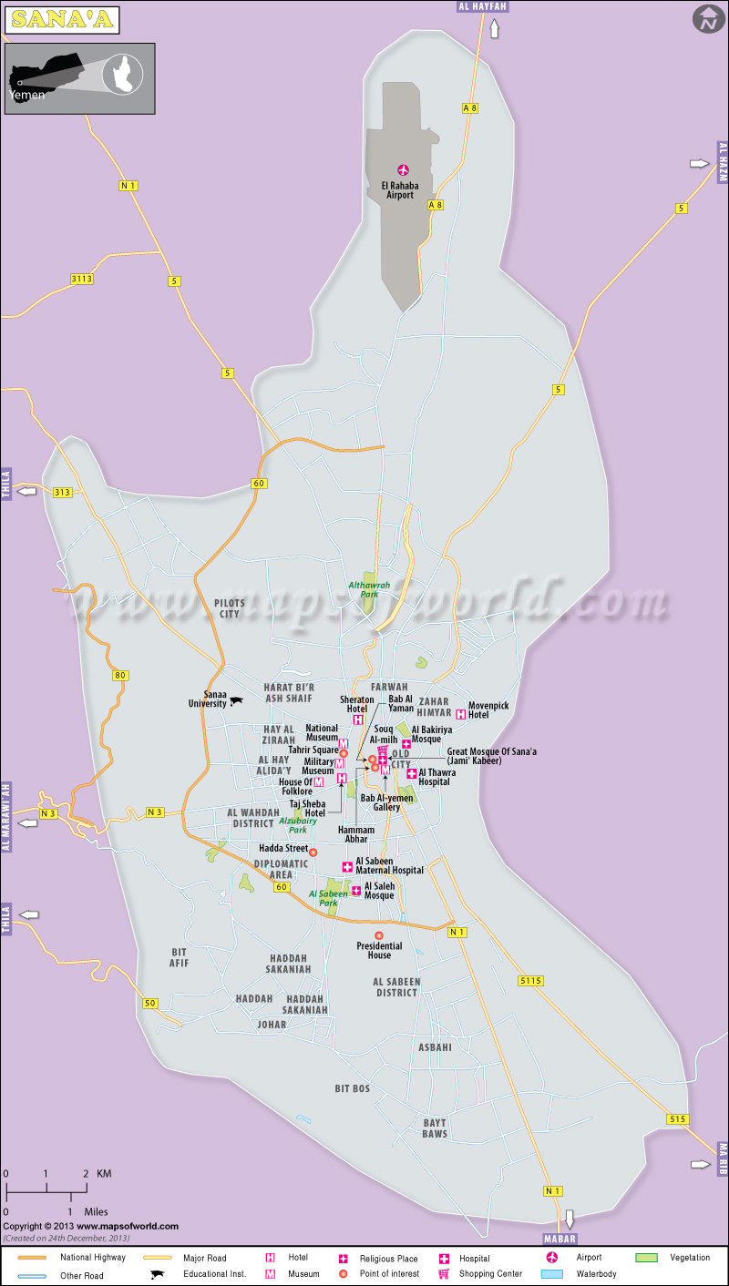
Facts about Sana’a |
| Country | Yemen |
| Time Zone | UTC+3 |
| Language | Arabic |
| Major Religion | Islam and Christians |
| Founded | 8BC |
| State | Amanat Al Asimah |
| Area | 119 km2 |
| Population | 134600 |
| Lat Long Coordinates | 15.0000° N, 48.0000° E |
| Points of interest | Bab al-Yemen |
| National Museum | |
| Military Museum | |
| Wadi Dhahr | |
| Great Mosque of Sana’a | |
| Al shab Mosque | |
| Thilaa | |
| Jabal an-Nabi Shu’ayb |
Sana’a is the capital city of the Republic of Yemen and lies in the middle of the western mountain range, which stretches from north to south of Yemen. Sana’a is also the centre of Sana’a Governorate and is surrounded by some other governorates like Dhamar to the south and Amran on the north, Hodiedah to the west and Al Jowf and Marib on the eastern side. On the northwestern side lie the governorates of Mahwit and Hajja.
Sana’a is one of the oldest towns of Arabia and was founded by Shem, one of the three sons of Noah. Sana’a was conquered twice by the King of Persia and was ruled for fifty years by the Abyssinians. During this period, a great cathedral was built and this was the centre of Christian pilgrimage in Arabia. Although Islam became the dominant religion of Yemen, this architectural building of Sana’a city was not demolished. Sana’a was conquered by Turansha in the late sixteenth century. After the fall of the Ottoman Empire, Sana’a became an independent city; although about 50,000 people still live in the old city.
The popular attractions of Sana’a are The Military Museum, The National Museum, Suq al-Milh and The Old City. Apart from these, there are many traditional mosques and buildings in Sana’a, which add a special appeal to the city.

 Hajjah City Map