Eastern Europe Map
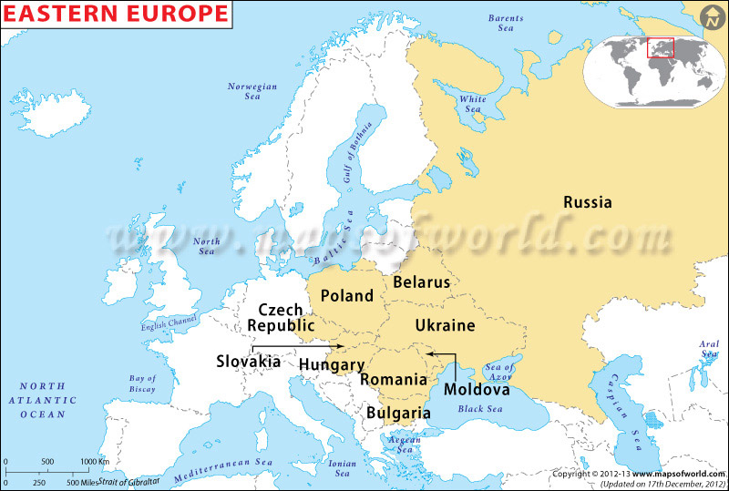
The map of Eastern Europe shows the countries that are located in the Eastern part of Europe. The Eastern European countries include Russia, Ukraine, Moldova, Poland, Bulgaria, Belarus, Czech Republic, Hungary and Republic of Moldova.
Map of Eastern Europe - Click on any Country for its Map and Information

-

Europe Classic Map
$13.84
-

Europe Executive Map
$13.84
-

Europe Political Map
$34.61
| Description : Eastern Europe map showing the political boundaries of countries which are the part of eastern Europe. | Disclaimer |
×
Disclaimer : All efforts have been made to make this image accurate. However MapSherpa, Inc, its directors and employees do not own any responsibility for the correctness or authenticity of the same.


