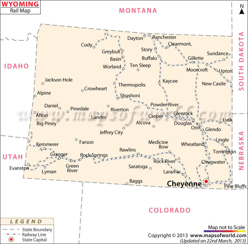
The Wyoming Railway Map points out the several rail routes of the state. The State of Wyoming had 3,070 kilometer of total railway lines in the year of 2000.
The railroad service providers of Wyoming offer excellent railway facilities to the local inhabitants of the state. Some of the notable railroad organizations of the State of Wyoming are Big Horn, Cheyenne and Northern RY, Citizen’s Street RY, Colorado RR, Clearmont and Buffalo RR, Cambria and Newcastle RR, Denver Pacific RY, Guernsey Dam, Laramie and Sweetwater Valley, Pacific RR, Wyoming and Black Hills and Wyoming and Missouri River. The railway tracks easily connect the important towns of Wyoming. The well laid railway lines join the main towns of Heyenne, Evanston, Green River, Larame, Wheatland, Douglas, Glenrock, Worland, Glendo and Thermopolis.
The establishment of the Union Pacific Railroad in the year of 1868 through Wyoming led to the development of modern railway systems in the state. The various railroad companies helped in the growth of the tourism industry in Wyoming. The railway lines transfer the freight goods from one area to another. The Amtrak Thruway Motorcoaches cater to the railway services of Wyoming. The Wyoming State Map identifies the important railway stations of the state.
 Wall Maps