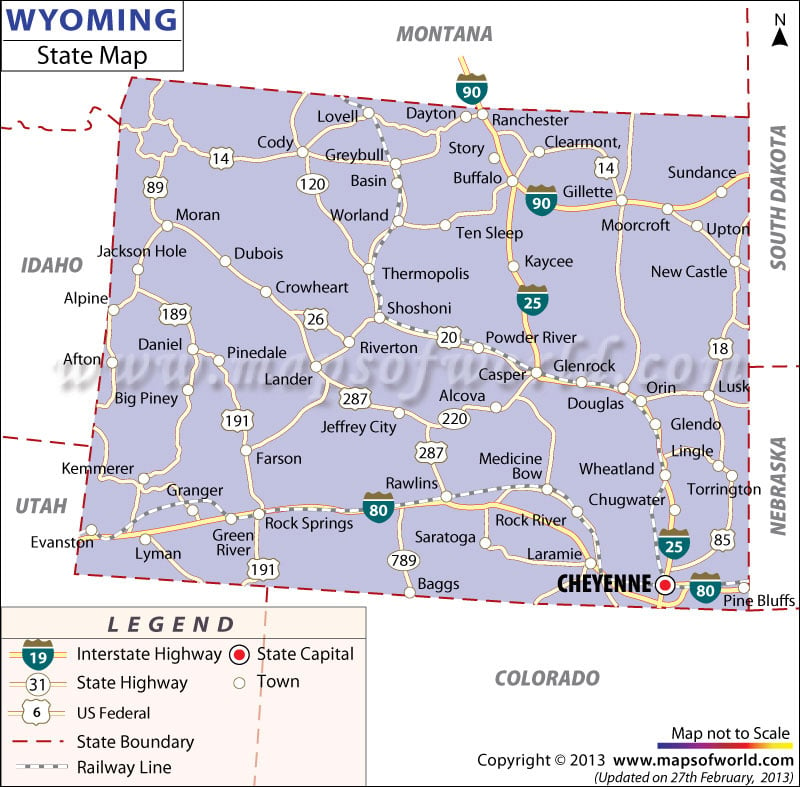
The Wyoming state map highlights the geographical position of several towns and cities, railway routes, roadways and capital city of the state.
Cheyenne, the capital of Wyoming, is prominently indicated in the map of the state. Also, towns like Saratoga, Big Piney, Dubois, Moorcroft, Crowheart, Alpine, Kaycee, Farson, torrington and many others are pointed out in the map of Wyoming. The Rocky Mountain zone on the northwest of United States of America houses the state of Wyoming. Green river and Rock river are indicated in Wyoming map.
Interstate 90, Interstate 25 and Interstate 80 are the prime roadways of the state that are shown in the map of Wyoming. The railway routes connecting Thermopolis, Wheatland, Douglas, Rock Springs, Greybull, Worland and several others are clearly highlighted in the Wyoming map. The Wyoming state map is a helpful guide which provides all relevant information about the place.
 Wall Maps