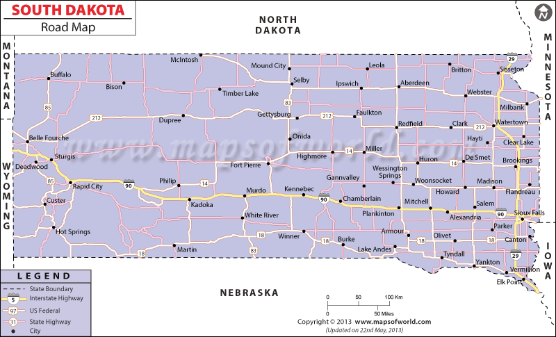
South Dakota state has 83, 471 miles of roadways that links the various towns and cities of the state.
Interstate 90 and interstate 29 are the two prime highways of South Dakota. While interstate 29 connects the north-south locations of the state, interstate 90 passes through the east-west regions of South Dakota. South Dakota Road Map offers a clear view of the road network of the state.
Apart from the interstate roads, the state of South Dakota is criss-crossed by a number of United States highways. The north-south road routes of US highways comprise US 77, US 385, US 85, US 81, US 183, US 83 and US 281. Whereas the east-west routes of South Dakota intersected by US highways include US 16, US 12, US 18 and US 14.
According to a survey of year 2000, South Dakota state is facilitated by 821,714 duly registered transportation vehicles.
The road map of South Dakota also highlights all the towns such as Pierre, Mission, Salem, Gregory, Gettysburg, Mitchell, Platte, Custer, Yankton, Miller, Webster and several others, which are well-connected by the roadways. The South Dakota state map is a significant indicator of the major road routes of the place.
 Wall Maps