- Louisiana Counties - Louisiana County Map, Map of Louisiana Counties
- Major Cities of Louisiana - New Orleans, Lafayette, Baton Rouge
- Neighbouring States - Arkansas, Mississippi, Texas
- Regional Maps - Map of USA
- Other Louisiana Maps - Louisiana Map, Where is Louisiana, Louisiana Airports Map, Louisiana Lat Long Map, Louisiana Zip Code Map, Louisiana Area Code Map, Louisiana National Parks Map
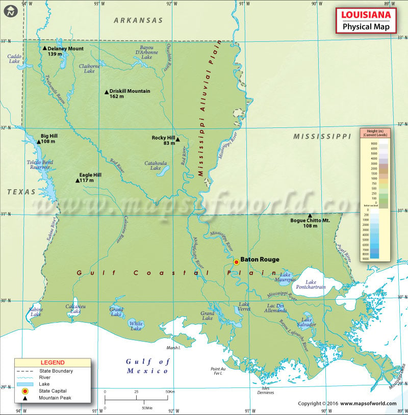
The state of Louisiana has three major physical regions: Mississippi alluvial plain, East gulf coastal plain and West gulf coastal plain.
The alluvial plain region stretches along the Mississippi river and the Gulf of Mexico from north to south. It features a terrain mostly made up of hollows and ridges. Cross Lake, Lake Claborne, Lake Bistineau are some of the notable lakes in the region. Low swamplands, coastal marshlands, and barrier islands cover roughly 20,000 square miles of an area in the region. The southern coast of the state, which comprises wetlands of Louisiana, is one of the fastest disappearing areas in the world.
The east and west gulf coastal plains refer to the areas lying to either side of the Mississippi River. Acadiana region is composed of low gentle hills to the north and dry-land prairies and bayous to the south closer to the Gulf Coast. Extensive prairies, hill country with dense pine forests, and scattered swamplands make up the geography of Central Louisiana. Kisatchie National Forest, the state’s only national forest, spans 600,000 acres of flatwoods in Central and North Louisiana.
The higher and contiguous hills cover more than 25,000 square miles in north and northwestern region of the state. With an elevation of 163 meters, Driskill Mountain (or Mount Driskill) is the highest natural point in Louisiana.
 Wall Maps