Highways In Louisiana
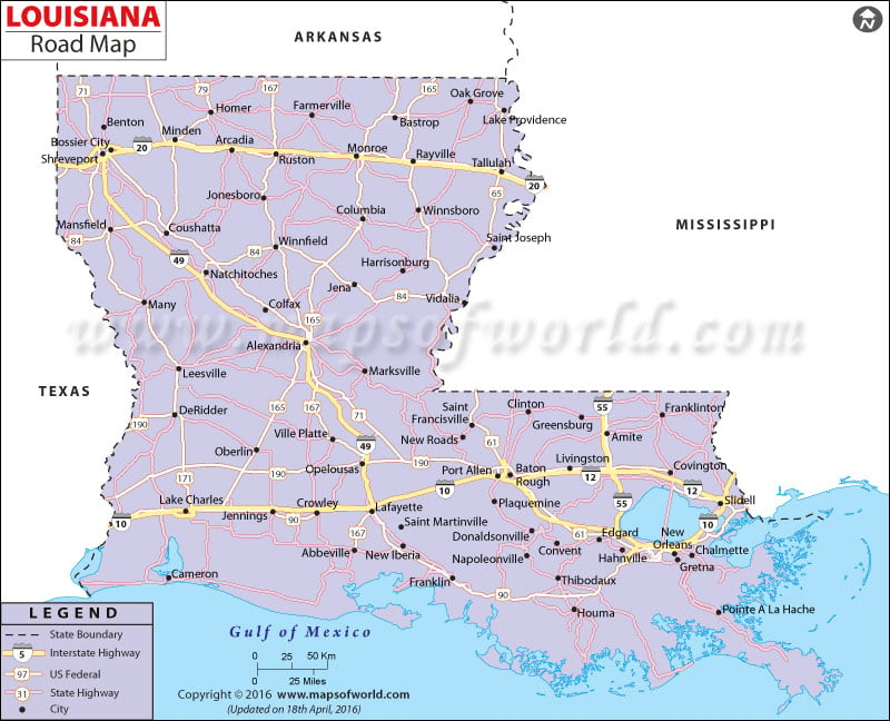
This map highlights the state and national highways that join all the major cities in Louisiana.
The Louisiana Department of Transportation and Development is responsible for the construction and maintenance of the roads and highways.
As of 2000, Louisiana had a total of 60,765 miles of road, 1,964,694 registered cars and 1,570,804 registered trucks.
The northern part of Louisiana is easily accessible from the southern end by Interstate Highway 49 and Interstate 55.
The eastern and western ends of Louisiana are connected by Interstate Highway 10, Interstate 12 and Interstate 20.
Some of the prominent US Highways include road routes 167, 90, 190, 71, 171, 84, 165, 79, 80 and 61.
Morgan City, Alexandria, Sulphur, Baton Rouge, Baker, Zachary, Opelousas, Crowley, Bogalusa, Houma, Pineville, De Ridder, Jennings, Lafayette, Thibodaux, Ruston, Monroe, Minden, Shreveport, Bastrop and Eunice are all connected by highways.
 Wall Maps