- Louisiana Counties - Louisiana County Map, Map of Louisiana Counties
- Major Cities of Louisiana - New Orleans, Lafayette, Baton Rouge
- Neighbouring States - Arkansas, Mississippi, Texas
- Regional Maps - Map of USA
- Other Louisiana Maps - Louisiana Map, Louisiana Physical Map, Louisiana Airports Map, Louisiana Lat Long Map, Louisiana Zip Code Map, Louisiana Area Code Map, Louisiana National Parks Map
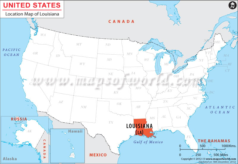
Louisiana is situated within the Lat long 31.0413° N, 91.8360° W and shares its northern border with Arkansas, eastern border with Mississippi, southern border with the Gulf of Mexico and western border with Texas.
The total length of the boundary of Louisiana is 1,482.42 miles. The state has a 7,704.12 mile long tidal shoreline and stretches to a length of 236.22 miles in its east-west direction and 235.6 miles in its north-south direction.
The state encompasses a total area of 76,678.5 square miles, with a total land area of 71,491.58 square miles and total inland water area of 5,186.92 square miles.
Facts About Louisiana |
|---|
| State Name | Louisiana |
|---|---|
| Continent | North America |
| Country | United States (USA) |
| Capital | Baton Rouge |
| Largest city | New Orleans |
| Area | 51,843 sq mi (135,382 km2) |
| Population | 4,649,676 (2014 est) |
| Lat Long | 31° 0′ 0″ N, 92° 0′ 0″ W |
| Official Language | English, French |
| Calling Code | |
| Time Zone | Central: UTC −6/−5 |
| Airport | 7- Airports in commercial service |
| Neighbour State | Mississippi, Arkansas, texas |
| Internet TLD | |
| Currency | United State Dollar (USD) |
 Wall Maps