6.7K
- Georgia Counties - Georgia County Map, Map of Georgia Counties
- Major Cities of Georgia - Atlanta, Savannah
- Neighbouring States - Tennessee, North Carolina, South Carolina, Florida, Alabama
- Regional Maps - Map of USA
- Other Georgia Maps - Georgia Map, Georgia Physical Map, Georgia Airports Map, Georgia Lat Long Map, Georgia Zip Code Map, Georgia Area Code Map, Georgia Nationaal Parks Map
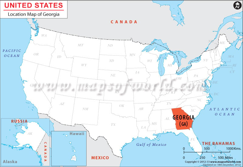
Georgia is a southeastern state situated within the coordinates 32.9605° N, 83.1132° W. Georgia’s total area spans 58,910 square miles, composed of 58,056 square miles of land and 158 square miles of inland water.
Georgia is bordered by Tennessee and North Carolina to its north, South Carolina to the east, Alabama to the west, and Florida to the south. Georgia also borders the Atlantic Ocean to the east. The total length of Georgia’s boundaries is 1,039 miles.
Facts About Georgia, USA |
|---|
| State Name | Georgia, USA |
|---|---|
| Country | US State |
| Capital and largest city | Atlanta |
| Area | 59,425 sq mi (153,909 km2) |
| Population | 10,097,343 (2014 est) |
| Lat Long | 33° 0′ 0″ N, 83° 30′ 0″ W (33, -83.5) |
| Official Language | English |
| Calling Code | |
| Time Zone | Eastern: UTC −5/−4 |
| Airport | |
| Neighbour countries | Tennessee, North and South Carolina, Alabama, Florida |
| Internet TLD | |
| Currency | US Dollar |
 Wall Maps