1.7K
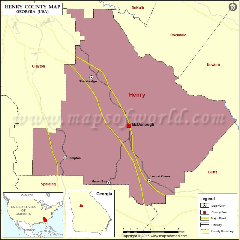
Check this Georgia County Map to locate all the state’s counties in Georgia Map.
Airports in Henry County
| Airport Name |
|---|
| Berry Hill Airport |
| Clayton County Tara Field |
| Deerfield Landing Airport |
| Diamond S Airport |
| Flying R Ranch Airport |
| Gorden E Bellah International Airport |
| Grant Airport |
| Henry Medical Center Inc Heliport |
| Holder’s Field |
| Mallards Landing Airport |
More Maps of Henry County
Cities in Henry County
| City | Population | Latitude | Longitude |
|---|---|---|---|
| Hampton city | 6987 | 33.383245 | -84.284705 |
| Heron Bay | 3384 | 33.339267 | -84.192137 |
| Locust Grove city | 5402 | 33.343489 | -84.106836 |
| McDonough city | 22084 | 33.440098 | -84.150301 |
| Stockbridge city | 25636 | 33.526133 | -84.228972 |
Golf Courses in Henry County
| Name of Golf Course | Latitude | Longitude |
|---|---|---|
| Cannongate At Heron Bay-Locust Grove | 33.33787 | -84.192934 |
| Canongate At Georgia National Golf Club-McDonough | 33.448919 | -84.074769 |
| Cottonfields Golf Course-McDonough | 33.41796 | -84.166587 |
| Crystal Lake Golf and Country Club-Hampton | 33.458181 | -84.249657 |
| Eagle’s Brooke Golf and Country Club-Locust Grove | 33.375227 | -84.157025 |
| Eagle’s Landing Country Club-Stockbridge | 33.508626 | -84.216936 |
 Wall Maps