996
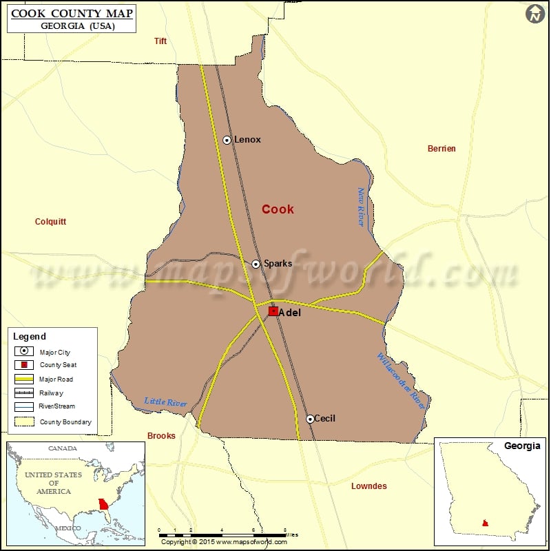
Check this Georgia County Map to locate all the state’s counties in Georgia Map.
Airports in Cook County
| Airport Name |
|---|
| Cook County Airport |
Cities in Cook County
| City | Population | Latitude | Longitude |
|---|---|---|---|
| Adel city | 5334 | 31.131649 | -83.425027 |
| Cecil city | 286 | 31.046573 | -83.390704 |
| Lenox town | 873 | 31.267256 | -83.467193 |
| Sparks town | 2052 | 31.169332 | -83.440527 |
Golf Courses in Cook County
| Name of Golf Course | Latitude | Longitude |
|---|---|---|
| Circlestone Country Club-Adel | 31.1179 | -83.440379 |
 Wall Maps