1.8K
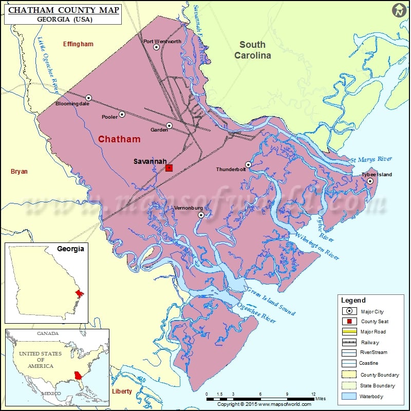
Check this Georgia County Map to locate all the state’s counties in Georgia Map.
Airports in Chatham County
| Airport Name |
|---|
| Hodges Airpark |
| Hunter Army Air Field |
| Hyatt Regency Hotel Heliport |
| Memorial Hospital Heliport |
| Savannah Hilton Head International Airport |
| St Joseph’s Hospital Heliport |
More Maps of Chatham County
Cities in Chatham County
| City | Population | Latitude | Longitude |
|---|---|---|---|
| Bloomingdale city | 2713 | 32.124889 | -81.307658 |
| Dutch Island | 1257 | 32.004653 | -81.031721 |
| Garden City city | 8778 | 32.086669 | -81.17715 |
| Georgetown | 11823 | 31.984766 | -81.226559 |
| Henderson | 1647 | 32.010199 | -81.265571 |
| Isle of Hope | 2402 | 31.984798 | -81.053156 |
| Montgomery | 4523 | 31.943871 | -81.108012 |
| Pooler city | 19140 | 32.102411 | -81.253894 |
| Port Wentworth city | 5359 | 32.194365 | -81.198329 |
| Savannah city | 136286 | 32.028254 | -81.178277 |
| Skidaway Island | 8341 | 31.93725 | -81.044853 |
| Talahi Island | 1248 | 32.033051 | -80.97613 |
| Thunderbolt town | 2668 | 32.033168 | -81.049583 |
| Tybee Island city | 2990 | 32.010014 | -80.852776 |
| Vernonburg town | 122 | 31.963817 | -81.125558 |
| Whitemarsh Island | 6792 | 32.030452 | -81.011015 |
| Wilmington Island | 15138 | 32.003606 | -80.975163 |
Golf Courses in Chatham County
| Name of Golf Course | Latitude | Longitude |
|---|---|---|
| Bacon Park Golf Course-Savannah | 32.006788 | -81.081642 |
| Crosswinds Golf Club-Savannah | 32.135162 | -81.231921 |
| Henderson Golf Club-Savannah | 32.005982 | -81.250646 |
| Hunter Golf Course-Savannah | 32.001749 | -81.133232 |
| La Vida Country Club-Savannah | 31.971684 | -81.148879 |
| Mary Calder Golf Club-Savannah | 32.09404 | -81.126259 |
| Savannah Quarters Country Club-Pooler | 32.075436 | -81.286607 |
| Southbridge Golf Club-Savannah | 32.067879 | -81.223574 |
| The Club At Savannah Harbor-Savannah | 32.08552 | -81.082866 |
| The Landings Club-Savannah | 31.932135 | -81.055487 |
| The Savannah Golf Club-Savannah | 32.071012 | -81.063373 |
| Wilmington Island Club-Savannah | 32.005019 | -80.994604 |
National Parks in Chatham County
| Name of Park | Latitude | Longitude |
|---|---|---|
| Fort Pulaski NM | 32.030837 | -80.938767 |
| Fort Pulaski NM | 32.028354 | -80.894318 |
| Fort Pulaski NM | 32.031803 | -80.888927 |
 Wall Maps