1.4K
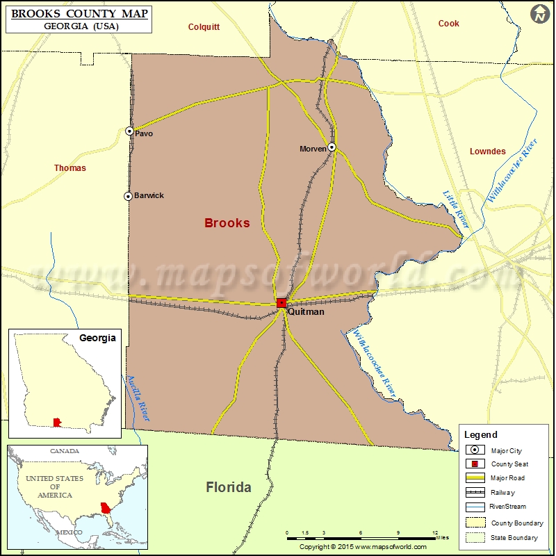
Check this Georgia County Map to locate all the state’s counties in Georgia Map.
Airports in Brooks County
| Airport Name |
|---|
| Paso Fino Farm Airport |
| Quitman Brooks County Airport |
More Maps of Brooks County
Cities in Brooks County
| City | Population | Latitude | Longitude |
|---|---|---|---|
| Barwick city | 386 | 30.893258 | -83.739135 |
| Morven city | 565 | 30.943344 | -83.500311 |
| Pavo city | 627 | 30.959746 | -83.737998 |
| Quitman city | 3850 | 30.784863 | -83.560318 |
Golf Courses in Brooks County
| Name of Golf Course | Latitude | Longitude |
|---|---|---|
| Quitman Country Club-Quitman | 30.771283 | -83.561975 |
 Wall Maps