About Santa Cruz City
The city of Santa Cruz is the county seat of the Santa Cruz County and covers an area of 15.828 sq mi with a population of about 59,946 approximately. The history of Santa Cruz dates back to 1769, when the Spanish explorer “Don Gaspar de Portola” discovered this land. The climate is mild over here and the average temperature of the city remains about 44 degree Fahrenheit.
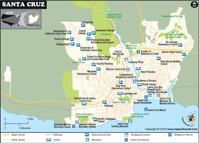
The main industries of Santa Cruz in California include agriculture, manufacturing, food processing, tourism and high tech parks. The educational facilities in Santa Cruz are pretty good and the city houses various schools, colleges and universities. The UC, Santa Cruz is a reputed institution of the city and presently it has enrolled about 15,000 students from the city and all over the globe. Various graduate and undergraduate courses are there and they follow a regular and systematic curriculum.
Santa Cruz of California can be called a quintessential town of beaches and is a favorite holiday spot among the visitors. Various sea side amusement parks along with the soaring waves provide a pleasure time to the guests. Parks are constructed on the open unused spaces and they provide recreational spots to the travelers.
Accommodation and dining facilities are excellent in Santa Cruz and various classes of hotels are there as per the visitors’ requirement. The tourist attractions in Santa Cruz are plenty, which include the Surfing Museum, the Clock Tour, the Museum of Natural history, Loch Lomond and Arana Gulch. All the attractions are just the panoramic views of Santa Cruz’s historical and cultural past.
While traveling to other cities in California, pay a visit to the beautiful city of Santa Cruz as it has numerous things to offer to the tourists.

