The iconic nine white letters atop Mount Lee are the face of Southern California. The image of SoCal is synonymous with sun, sand, and surf. Lured by the dreams of Californication, people from all walks of life flock here in a hope to find a cure for life.
From the glamorous Pacific Coast to the expansive Mojave Desert, it is a region of hedonistic pleasures where uncanny and bizarre is commonplace and where a star is born every other second. Being the hub of the motion picture industry, it’s a place where everything happens just before it happens elsewhere.
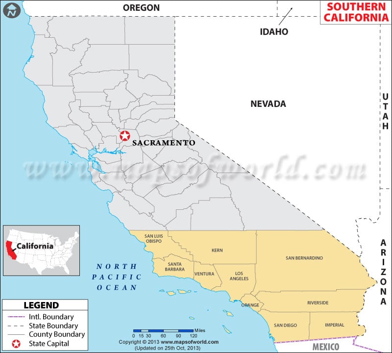
There are 10 counties within the bounds of Southern California. Due to mild winters and pleasant summers, Southern California is a year-round destination for travelers and transients. The Getty Center, Griffith Park & Observatory, Hollywood Walk of Fame, and Disneyland are prominent places to visit in Los Angeles.
The Death Valley National Park, Channel Islands National Park, Mojave National Preserve, and Santa Monica Mountains National Recreation Area are popular destinations to enjoy outdoors. Californians love to take a dip in the Pacific or enjoy walks on the boardwalks in fabled seaside communities.
Important Cities in Southern California
The Greater Los Angeles Area, Inland Empire, and Greater San Diego are major population centers in the region. Here are the major cities –
- Los Angeles
- San Diego
- Long Beach
- Bakersfield
- Anaheim
- Santa Ana
- Riverside
- Chula Vista
- Irvine
- San Bernardino
Getting In and Around
Los Angeles International Airport (LAX) is the busiest airport in California. Airports in San Diego, Orange County, Burbank and Long Beach are served by domestic flights.
The city of Los Angeles and San Diego are served by Amtrak as well as regional trains.
I-5, I-8, I-10, and I-15 are primary interstate highways in Southern California.
 Wall Maps