- California Counties - California County Map, Maps of California Counties
- Major Cities of California - San Jose, Santa Barbara, Santa Cruz, Fresno, Los Angeles, Monterey, Palm Springs, Redding, Riverside, Sacramento, San Francisco, Anaheim, Bakersfield, Central San Francisco
- Neighbouring States - Oregon, Nevada, Arizona
- Regional Maps - Map of USA
- Other California Maps - California Map , California Physical Map, California Airports Map, California Lat Long Map, California Zip Code Map, California Area Code Map, California National Parks Map
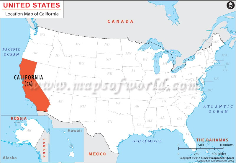
Where is California Located
California is a state located on the west coast of the United States. It is bordered by Oregon to the north, Nevada to the east, and Arizona to the southeast. To the south of California is the international border with Mexico, and to the west is the Pacific Ocean. California is the most populous state in the US and is known for its diverse geography, which includes the Sierra Nevada mountain range, vast forests, and extensive coastline. The state is also home to several major cities, including Los Angeles, San Francisco, and San Diego.
Facts About California |
|---|
| State Name | California |
|---|---|
| Country | USA |
| Continent | North America |
| Capital | Sacramento |
| Largest city | Los Angeles |
| Area | 163,696 sq mi (423,970 km2) |
| Population | 38,802,500 (2014 est) |
| Lat Long | 37° 0′ 0″ N, 120° 0′ 0″ W |
| Official Language | English |
| Calling Code | |
| Time Zone | Standard time PST (UTC−8) Summer time (DST) PDT (UTC−7) |
| Airports in California | 88 Airports |
| Neighbour countries | Mexico |
| Internet TLD | |
| Currency | US Dollar |
 Wall Maps