Arizona Railroad
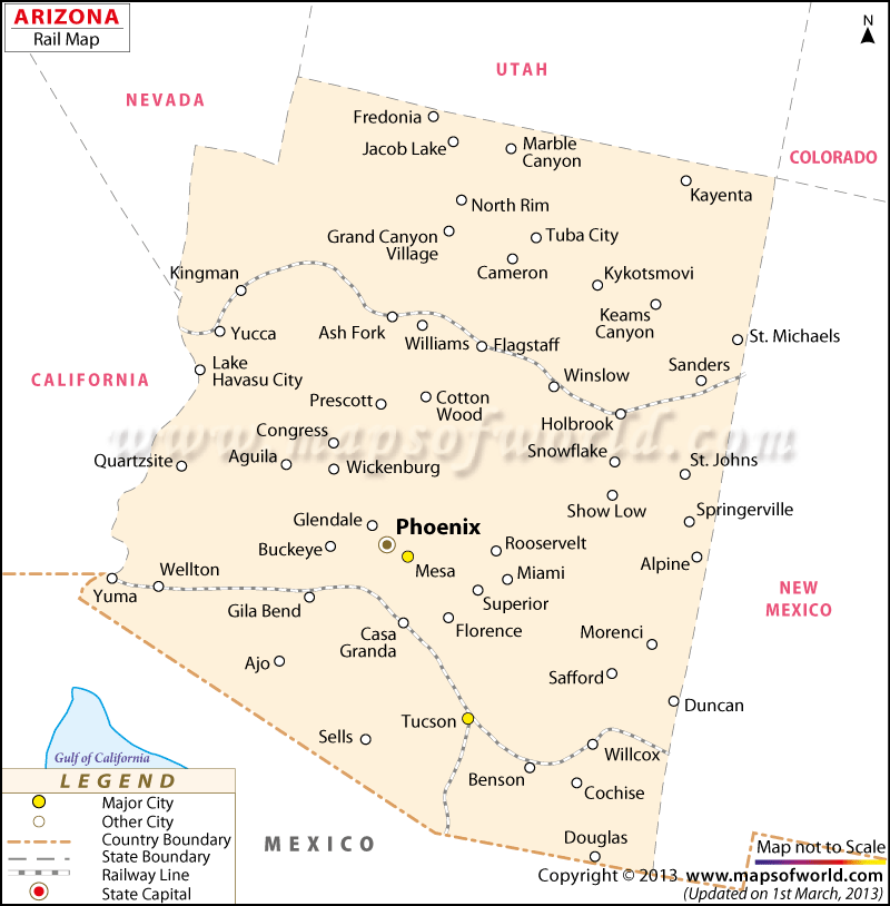
Arizona Railway map helps locate the important railway stations, railway network, state capital, major towns, and other towns in Arizona. It is a helpful guide for the tourists coming for the first time in the state.
What Arizona railroad map shows :
Amtrak, or the National Railroad Passenger Corporation, provides two itineraries across Arizona :
1) The Sunset Limited starts from New Orleans and ends at Los Angeles with stations in Benson, Tucson, Maricopa, and Yuma.
2) The Southwest Chief starts from Chicago and ends at Los Angeles with stations in Winslow, Flagstaff, Williams and Kingman. For the most part of its itinerary, the Southwest Chief goes along the famous Route 66, and provides a fascinating view of the well known road and its neighboring areas.
A light rail system known as Valley Metro Rail or METRO was recently accomplished in Phoenix. The operations formally started in December 2008. It joins Central Phoenix with the neighboring cities of Tempe and Mesa. There are preparations for extension in the future.
 Wall Maps