Falls International Airport Terminal Map
This is a zoomable map of the Falls International Airport showing the location of shops and restaurants at the airport.

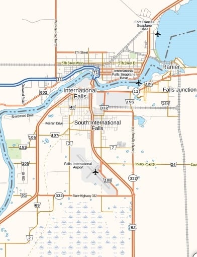
This customizable Map of INL Airport shows nearby areas of the airport, and you can also order this map in high-quality print in different sizes from our map store MapTrove. Falls International Airport is an international airport in Koochiching County, Minnesota, United States. Its short name is INL.
This customizable Map of INL Airport shows nearby areas of the airport, and you can also order this map in high-quality print in different sizes from our map store MapTrove. Falls International Airport is an international airport in Koochiching County, Minnesota, United States. Its short name is INL.
This is a zoomable map of the Falls International Airport showing the location of shops and restaurants at the airport.
This website uses cookies to improve your experience. We'll assume you're ok with this, but you can opt-out if you wish. Read More