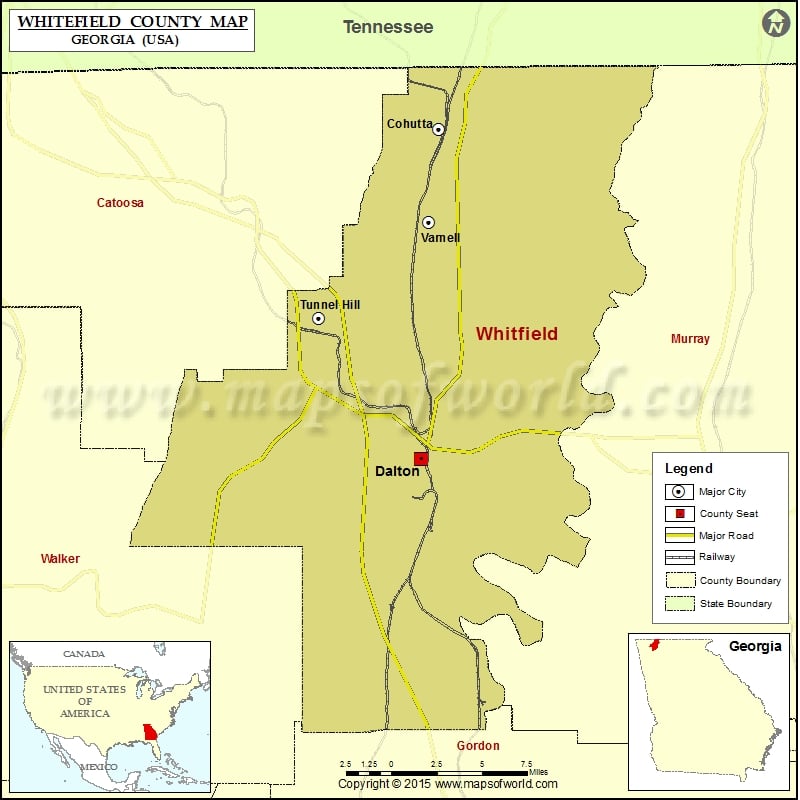
Whitfield County Map, Georgia
Check this Georgia County Map to locate all the state’s counties in Georgia Map. Mountain Peaks in Whitfield County Mountain Peak/Hill Elevation [Meter] Barn Mountain 413 Blue Mountain 401 Chestnut Mountain 495 Dug…
Check this Georgia County Map to locate all the state’s counties in Georgia Map .
Mountain Peaks in Whitfield County
Mountain Peak/Hill
Elevation [Meter]
Barn Mountain
413
Blue Mountain
401
Chestnut Mountain
495
Dug Mountain
553
Fort Hill
240
Gobblers Knob
318
Hamilton Mountain
272
Hurricane Mountain
472
Middle Mountain
463
Mount Rachel
270
Nebo Knob
287
Pitner Hill
305
Rocky Face Mountain
482
Signal Hill
352
Airports in Whitfield County
Airport Name
Dalton Municipal Airport
Hamilton Medical Center Heliport
Pratermill Flight Park Airport
Cities in Whitfield County
City
Population
Latitude
Longitude
Cohutta city
661
34.95385
-84.959034
Dalton city
33128
34.768966
-84.970974
Tunnel Hill City
856
34.847762
-85.040594
Varnell city
1744
34.901441
-84.965349
Golf Courses in Whitfield County
Name of Golf Course
Latitude
Longitude
Dalton Golf & Country Club-Dalton
34.803597
-84.954757
Nob North Golf Course-Cohutta
34.921115
-84.953207
The Farm Golf Club-Rocky Face
34.771831
-85.036613
Tunnel Hill Golf Course-Tunnel Hill
34.840068
-85.047359

 Wall Maps