Troup County Map, Georgia
Check this Georgia County Map to locate all the state’s counties in Georgia Map. Mountain Peaks in Troup County Mountain Peak/Hill Elevation [Meter] Hogg Mountain 264 Airports in Troup County Airport Name Grayhill…
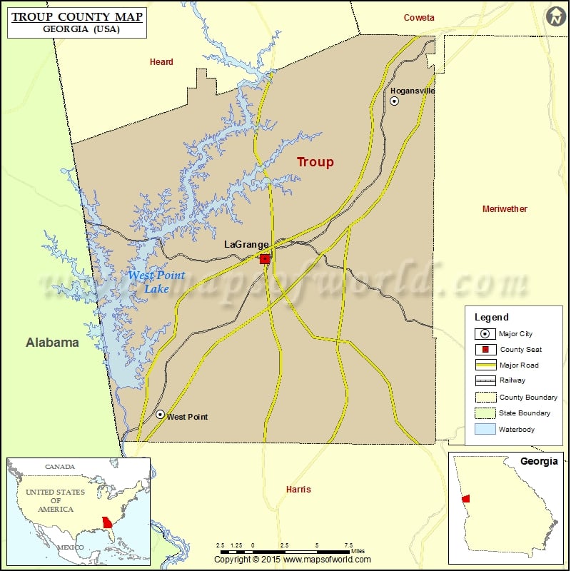
Check this Georgia County Map to locate all the state’s counties in Georgia Map .
Mountain Peaks in Troup County
Mountain Peak/Hill
Elevation [Meter]
Hogg Mountain
264
Airports in Troup County
Airport Name
Grayhill Airport
Johnson Memorial Airport
Lagrange Callaway Airport
West Georgia Medical Center Heliport
Cities in Troup County
City
Population
Latitude
Longitude
Hogansville city
3060
33.166911
-84.90348
LaGrange city
29588
33.02962
-85.037299
West Point city
3474
32.895123
-85.144781
Golf Courses in Troup County
Name of Golf Course
Latitude
Longitude
American Legion Golf Club-Lagrange
33.009024
-85.017902
Highland Country Club-Lagrange
33.062068
-85.057263
Hogansville Golf Club-Hogansville
33.192703
-84.905577
The Fields Golf Club-Lagrange
32.942835
-84.963659
The First Tee of Troup County-Lagrange
33.040047
-85.00472

 Wall Maps